
 Steintore
Click on a photo to enlarge it.
Steintore
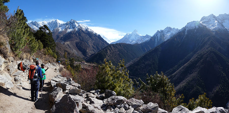
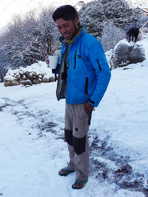
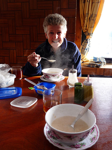
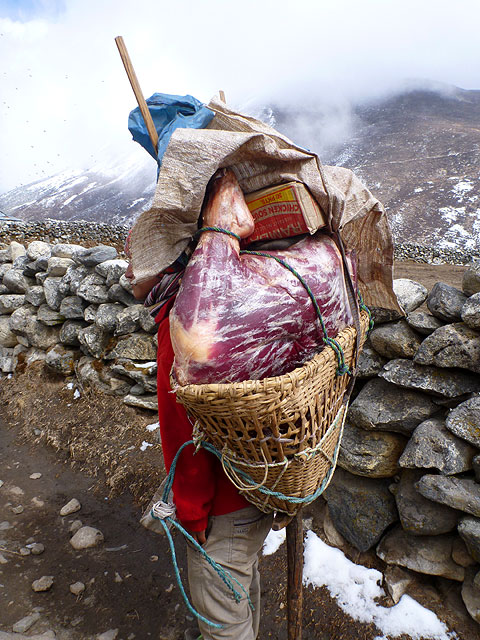
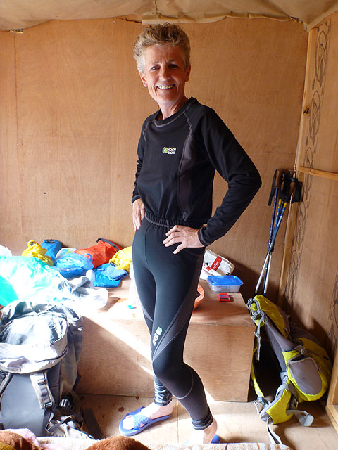
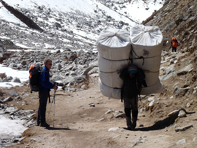
We left Namche the following day carrying all our wet weather gear, lots of toilet paper and 2kg of water each. Poor Lakpa, our porter, was now loaded up with two rented sleeping bags, extra water and 40 bars of chocolate! We had stocked up in Namche because the prices would go up to around $3 US dollars per bar! It was the chocolate that got us up the hills - saying to each other "At the top, we'll share a Snickers" was the motivation we needed. And it worked!
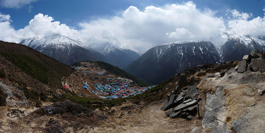
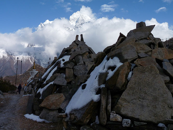
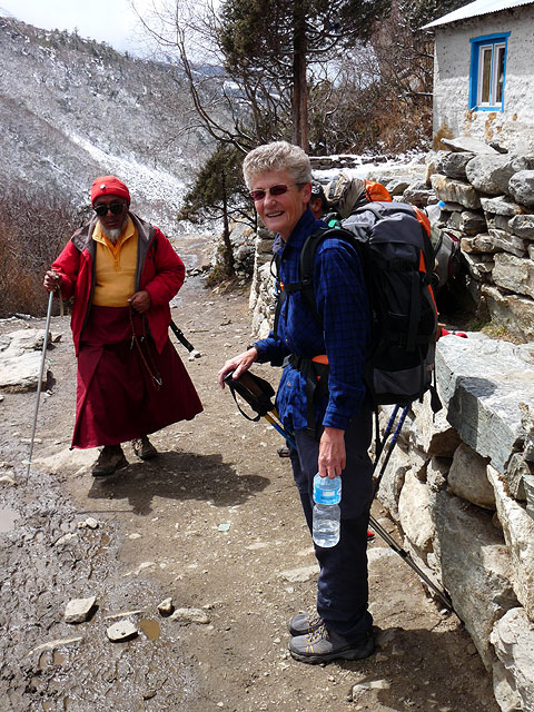
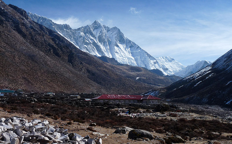
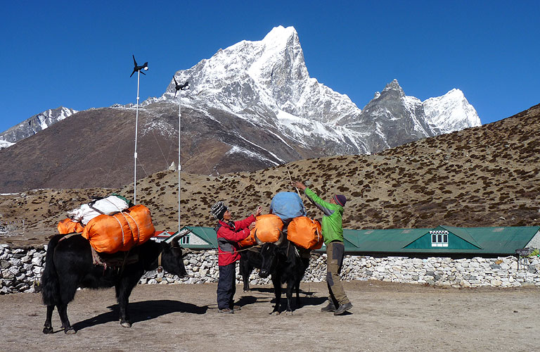
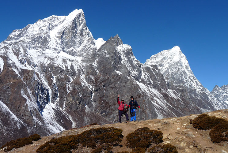
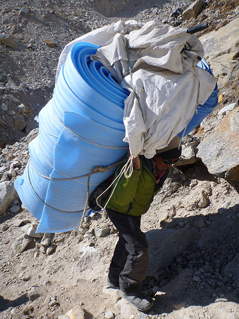
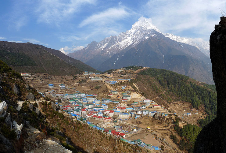
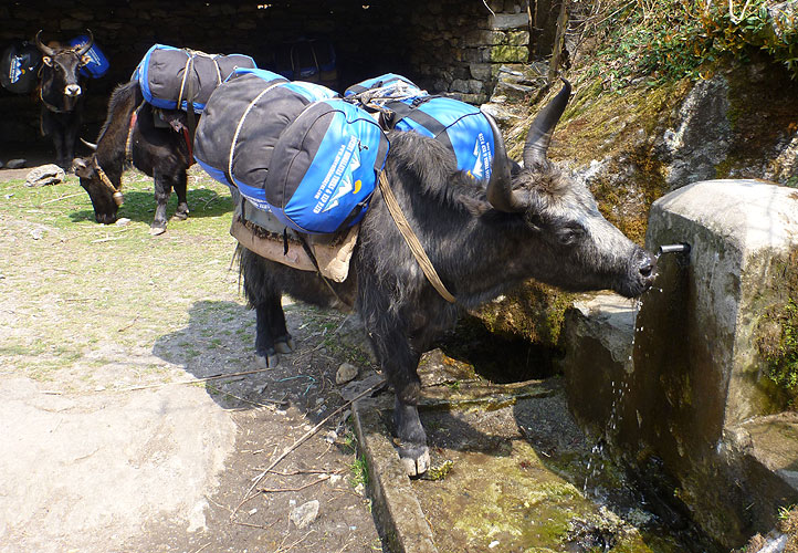
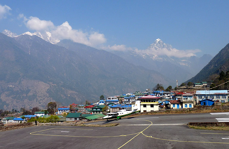
We were doing an acclimatisation day and just walking 2km up to Khumjung - 400m of steep and muddy ascent that would take us up to 3780m for the night. We walked across the landing strip at the airport above Namche and saw a huge amount of trekking expedition goods that had been flown in and were due to be transported up to Everest Base Camp by Yaks.
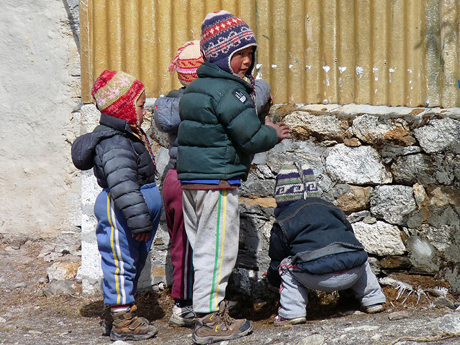
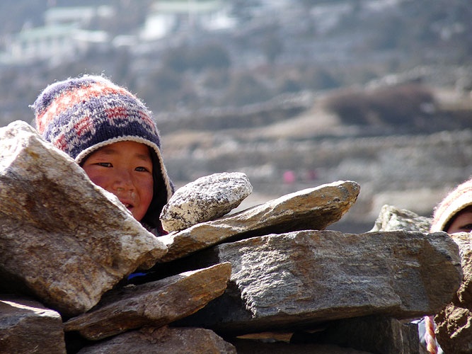
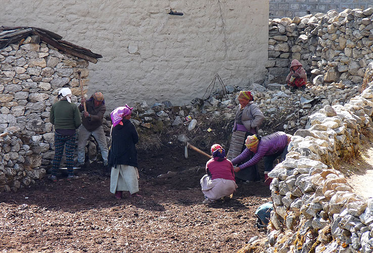
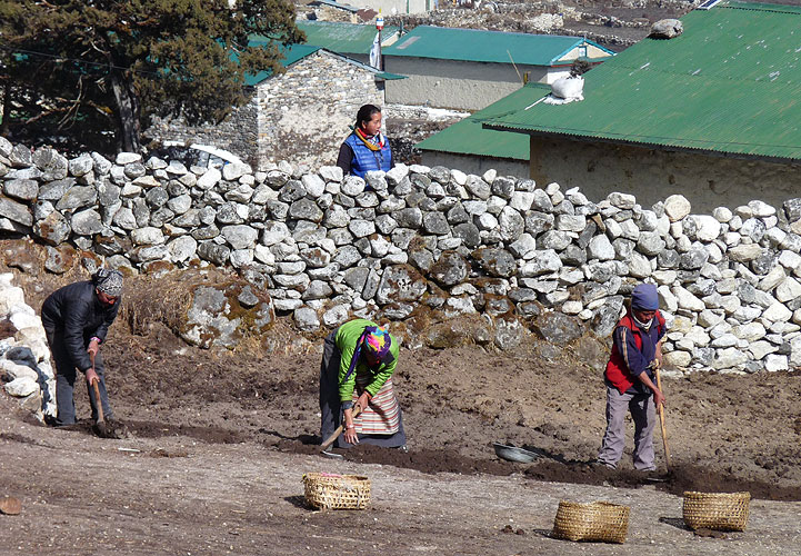
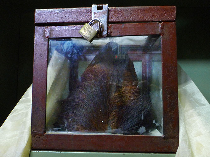
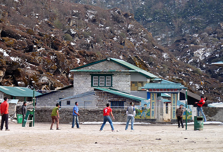
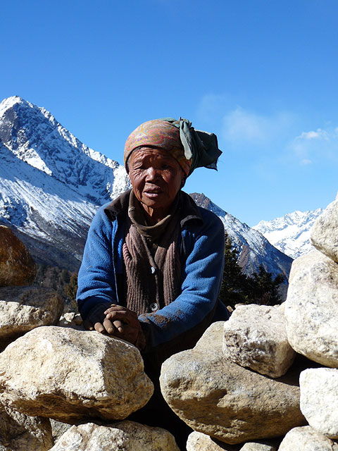
We arrived in Khumjung early and went for a walk around the village. We were surrounded by mountains and glaciers. It was really quite beautiful. We spoke to women planting potatoes in the fields, amazed that they can grow at this altitude and also we went into the monastery to see the "Yeti" skull. It was supposedly the real deal and therefore proof that Yeti's do exist. Who knows? There are a lot of people who believe in them.
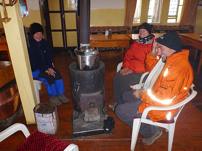
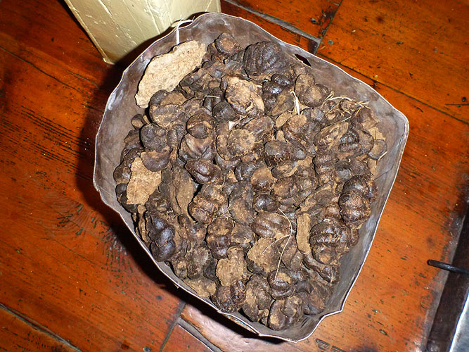
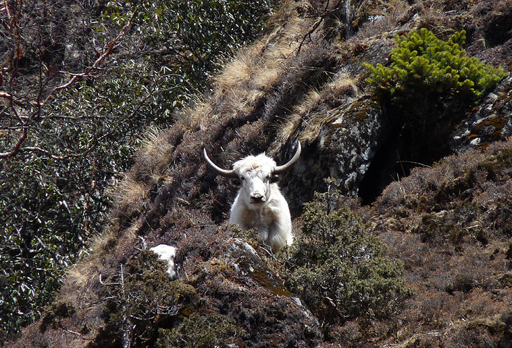
It was very cold and we needed a fire at the tea house where we stayed with a couple from Montreal, Canada. They used dried Yak dung for the fire which is obviously a very good burning fuel and doesn't smell unpleasant. But when a gust of wind came down the flue and blew smoke all over us I said that the Yak had just farted which kept us all laughing for a while!
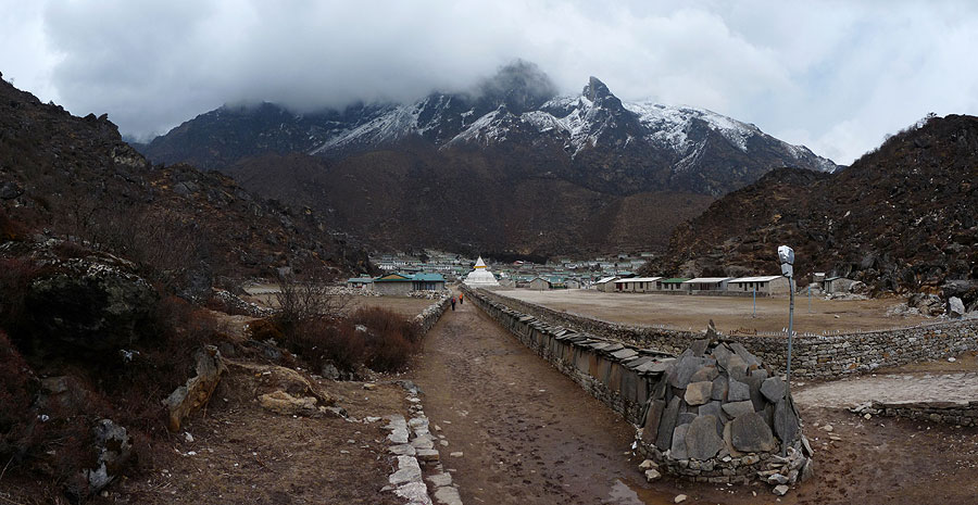
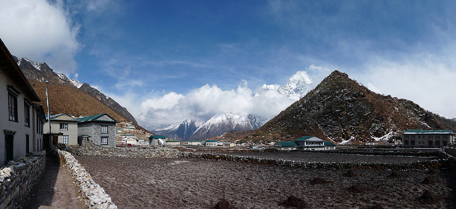
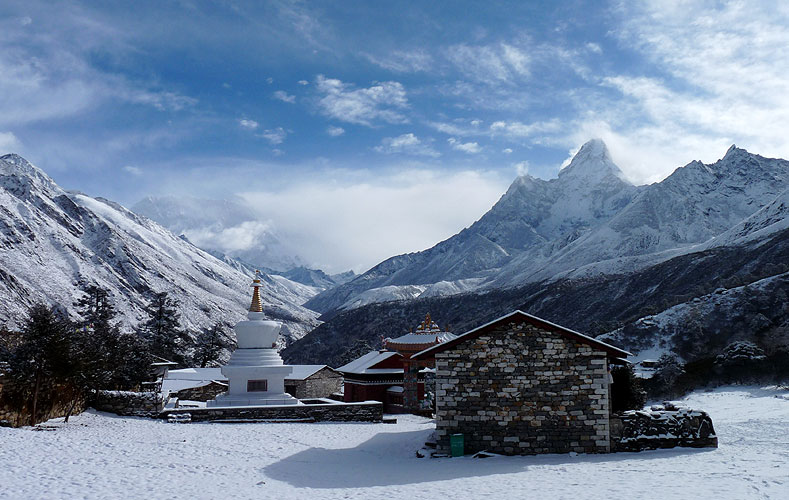
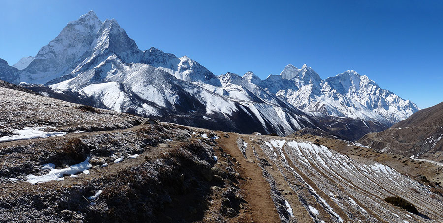
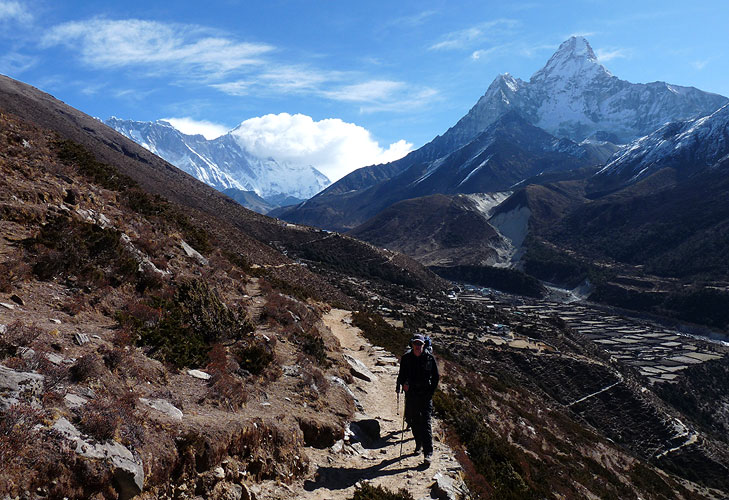
It went below freezing overnight and we were still cold despite using our sleeping bags. It was still very cold the next day but we were treated to a beautiful blue sky, surrounded by snow capped mountains as we took the steep trail downhill and then back up zig zags to Tengboche.
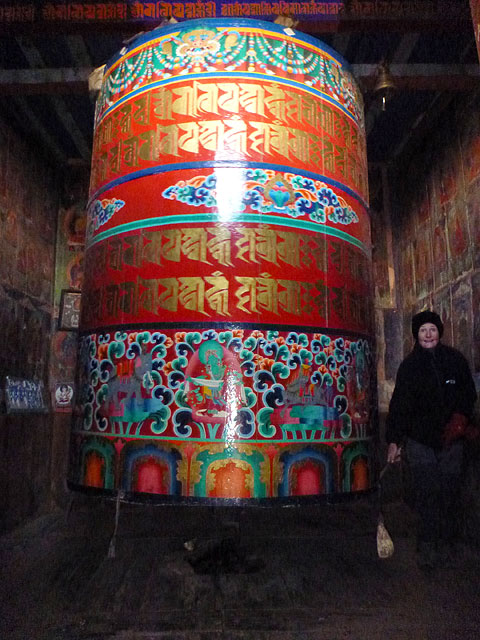
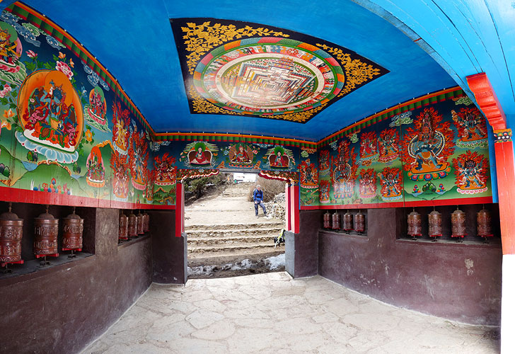
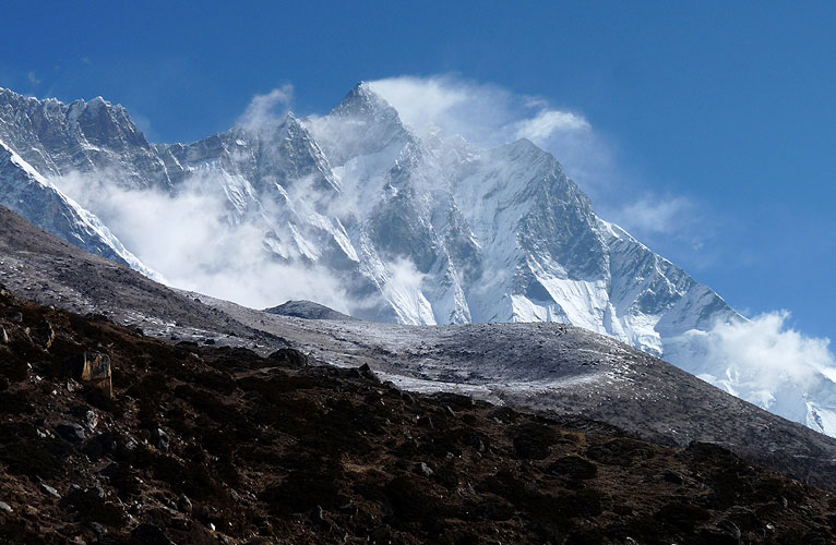
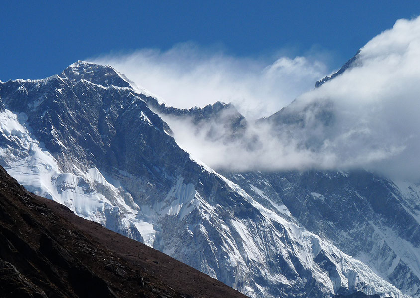
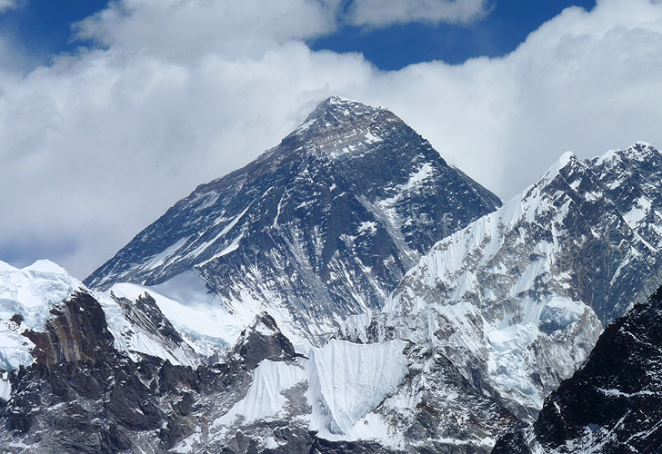
We had great views of Everest and Lhotse and went into another monastery to watch the monks praying. We had to take our shoes off to go inside and it was bitterly cold, already below freezing. A group of tourists stayed silent as we watched the monks chanting for 30 minutes.
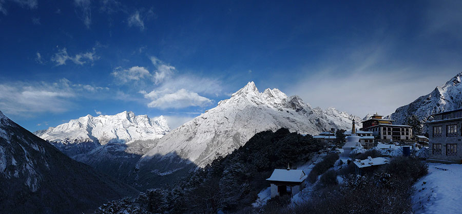
It snowed overnight and we were treated to a Winter Wonderland the next morning.
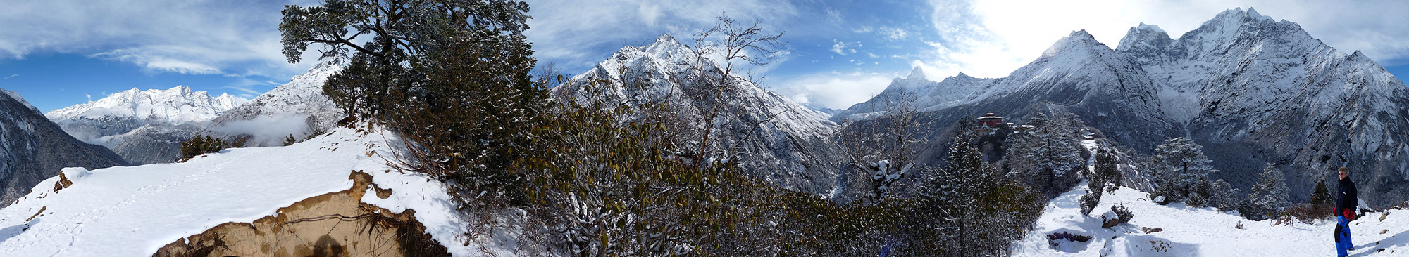
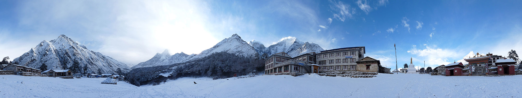 Winter Wonderland in Tengboche - 360° Panorama
(move mouse over panorama and click on the arrows)
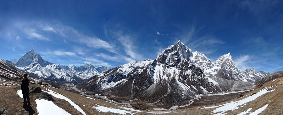
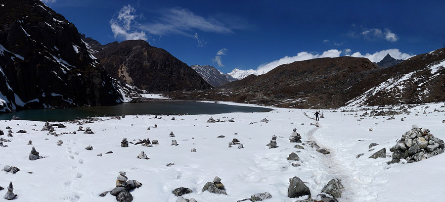
We walked through the pristine snow and went out to a viewpoint before setting off on the extremely slippery and icy trek to Dingboche (4410m).
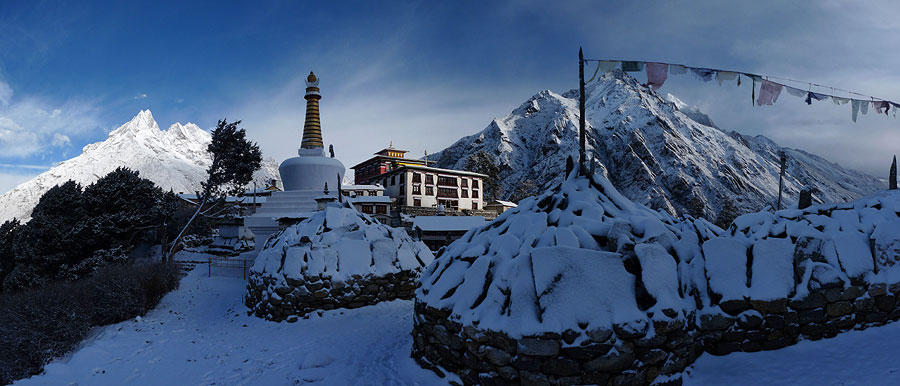
 Viewpoint in Tengboche - 360° Panorama
(move mouse over panorama and click on the arrows)
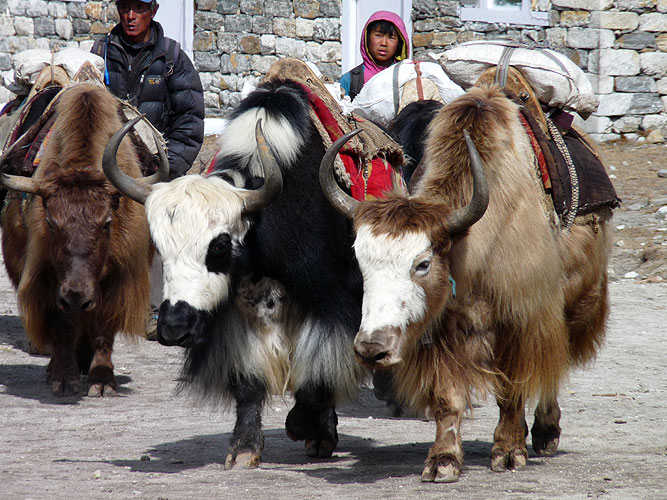
The yaks had set off before us so we weren't going to get lost because the trail was obvious but it wasn't an easy walk and we had to be very careful. At one point we followed someone else's guide who took a short cut and we ended up scrambling up rocks, trying to avoid slipping and falling down into the valley hundreds of metres below! We should have stuck to the main path!
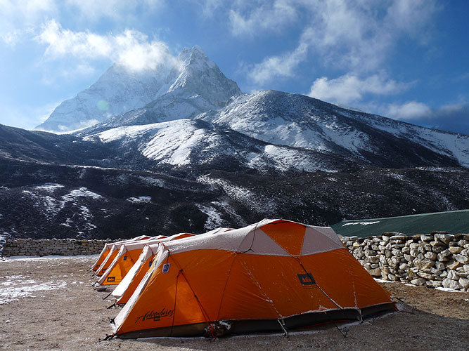
We stayed in Dingboche along with a group from REI - an American sports goods company - who also do camping trips. It went down to minus 15 degrees C overnight for those two nights and we struggled to keep warm despite the Yak dung fire.
There is no heating inside the rooms which only have wooden panelling for walls. The toilets froze. We had to bash through the thick layer of ice on top of the large barrel of water used to flush the toilet, and even Kirsten's toothbrush froze! Everything froze!
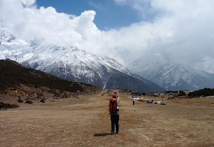
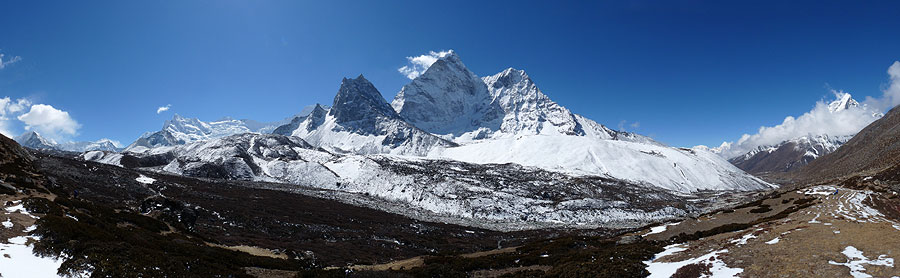
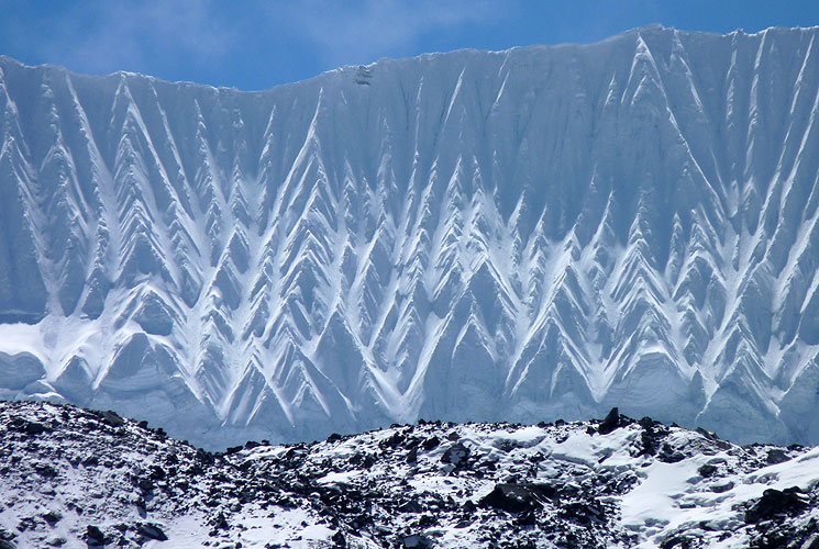
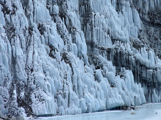
We stayed for two nights to do another acclimatisation day and walk up the Chhukung Valley to 4730m. The valley is wonderful and we got great views of Lhotse and the wall, Nuptse, Ama Dablam and a fantastic glacial wall. After lunch at one of the tea houses, we returned to Dingboche but were walking into a bitterly cold wind.
Kirsten got a migraine that evening - not from altitude but from a neck problem. After she was physically sick, she felt better. This is normally what happens when she gets a migraine so we didn't think it had anything to do with altitude. But it certainly wasn't what she needed in this brutally cold place. Somehow we managed to survive another night at minus 15. (It warmed up 10 degrees to minus 5 for the following night!)
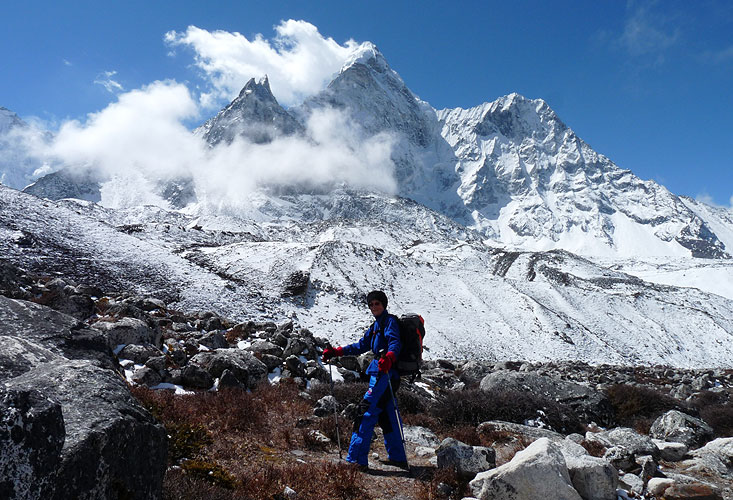
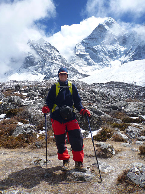
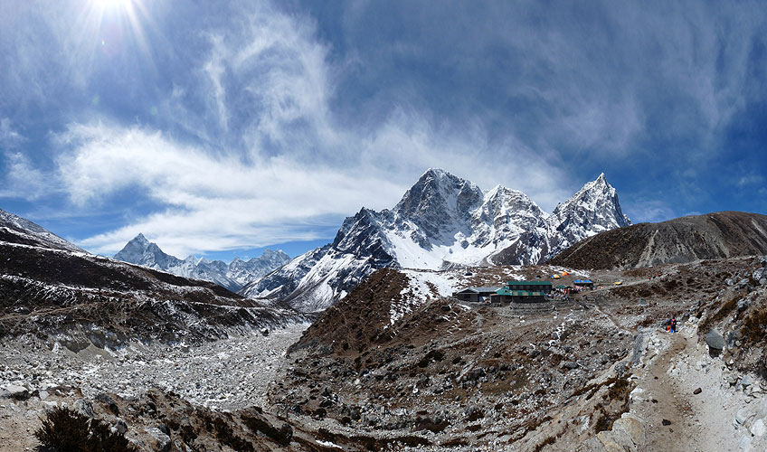
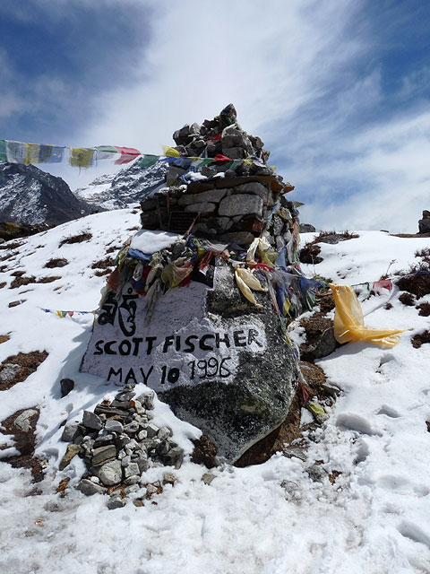
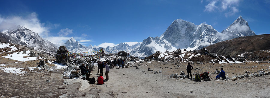
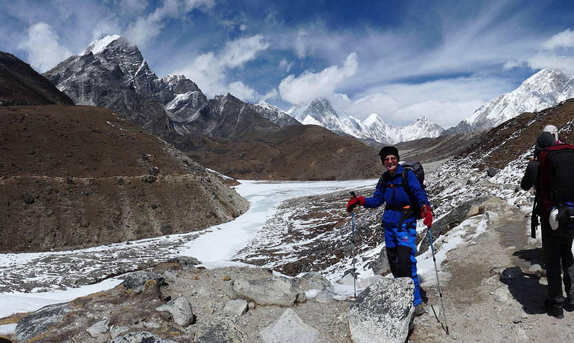
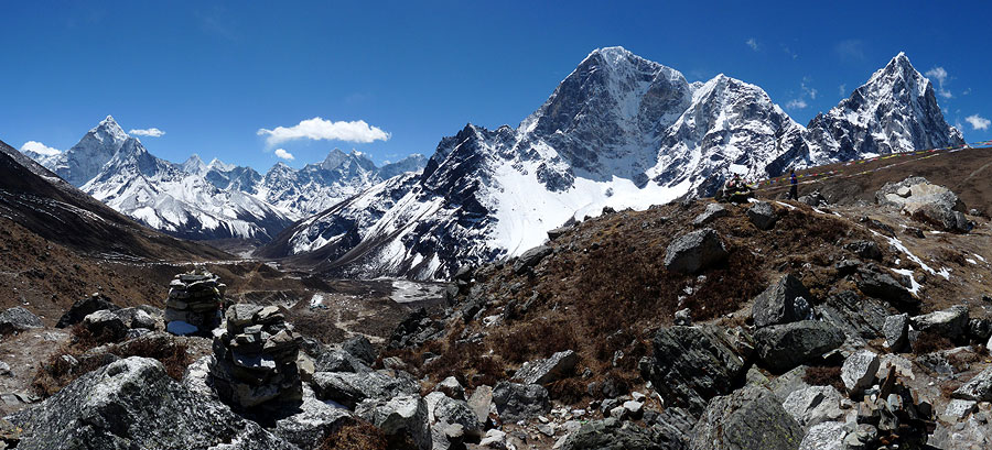
We were treated to another fantastic blue sky with a backdrop of white mountains as we walked over the top of a plateau to Dugla and then up a very steep zig zag path to the top of Thokla Pass (4830m) where there is a memorial area for a number of mountaineers and Sherpas who have died on Everest, including Scott Fischer made famous in Jon Krakauer's book "Into Thin Air" about the 1996 Everest disaster when so many were killed.
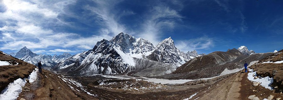
 Above Pheriche on the way to Dugla - 360° Panorama
(move mouse over panorama and click on the arrows)
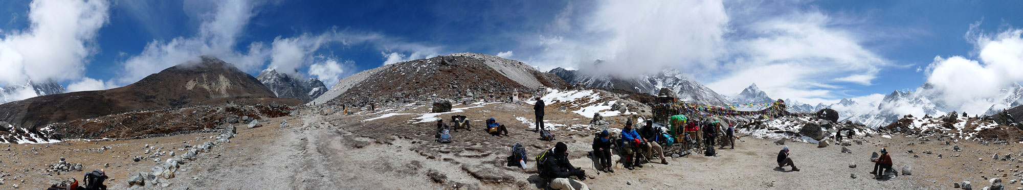 Thokla Pass (4830m) - 360° Panorama
(move mouse over panorama and click on the arrows)
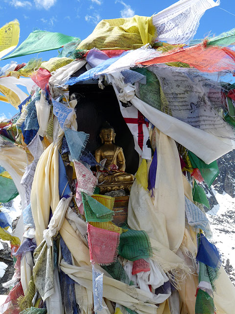
 Memorial area climbers who have died on Everest - Thokla Pass (4830m) - 360° Panorama
(move mouse over panorama and click on the arrows)
That evening we had an interesting conversation with an American in Lobuche who was doing a documentary on sex trafficking in India. The people you meet at almost 5,000m!!! Quite amazing!
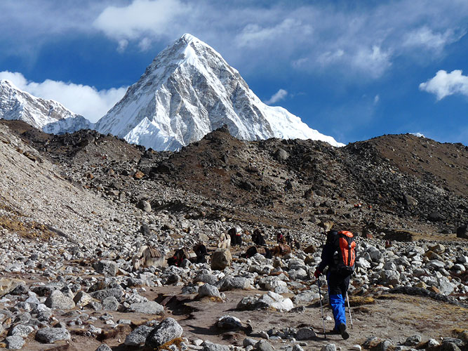
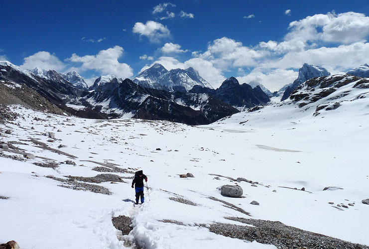
The walk up to Gorak Shep (5180m), the last tea houses before Everest Base Camp, involved a lot of ups and downs, some really steep, and it felt as if we would never get there. Each time we got to the top of a rise, we saw that there was another steep downhill and yet another rise ahead. When you are up at 5,000m every step takes far more energy and when I finally got to the last rise and saw Gorak Shep below, I lifted my arms up and punched the air in celebration.
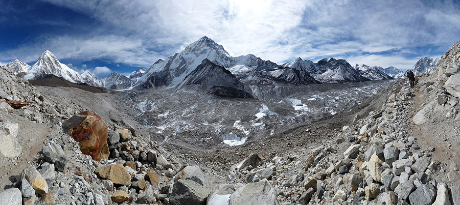
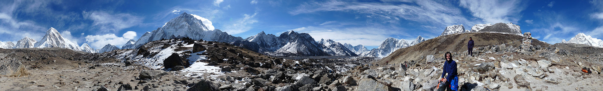 On the way to Gorak Shep (5140m) - 360° Panorama
(move mouse over panorama and click on the arrows)
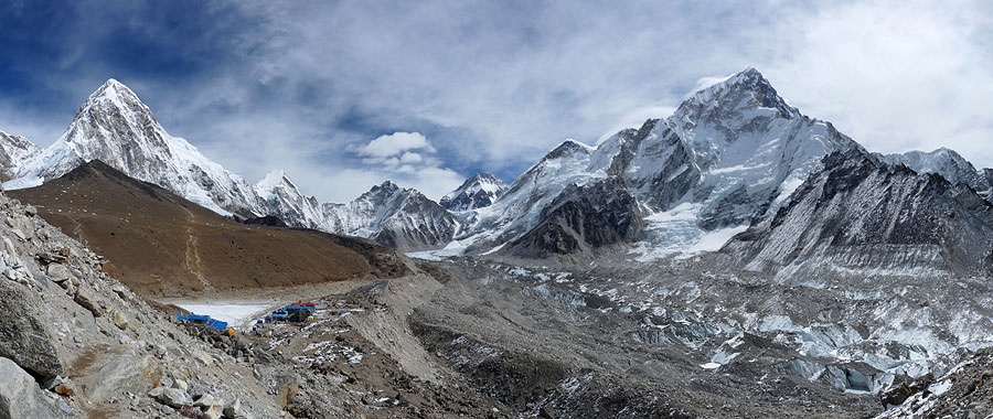
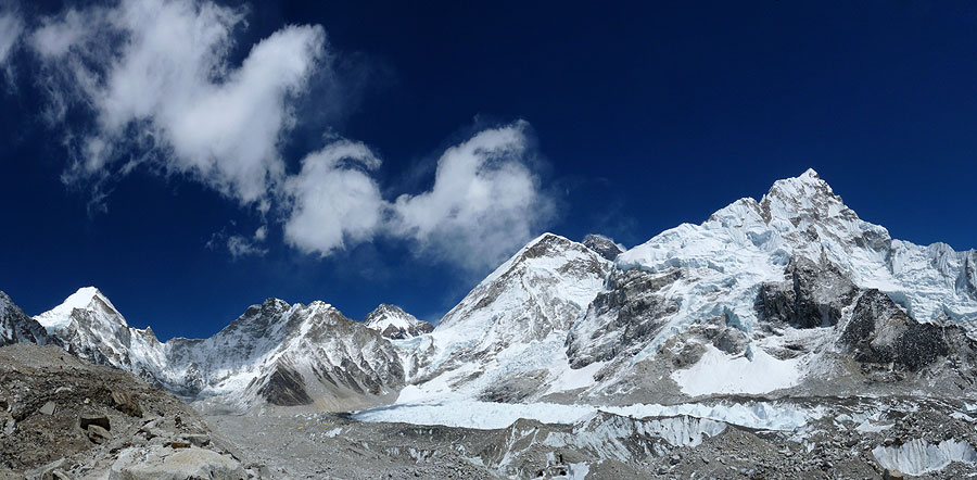
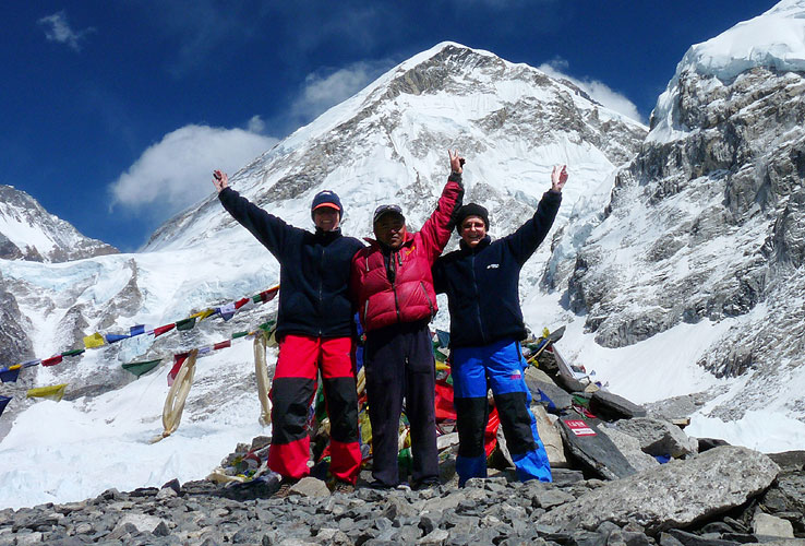
It had only taken us 3 hours to get there but felt a lot longer. We found a room, had some lunch and then set off for our final destination - Everest Base Camp. It was another tough walk and took us 2 hours. We saw several of the people we'd met along the way who were already on their way back. We crossed part of a glacier and finally arrived.
It was a truly wonderful feeling as we walked up to all the prayer flags denoting our arrival at this famous place. Kirsten even shed a few tears because we'd finally made it and took a video of me placing my prayer scarf amongst all the flags.
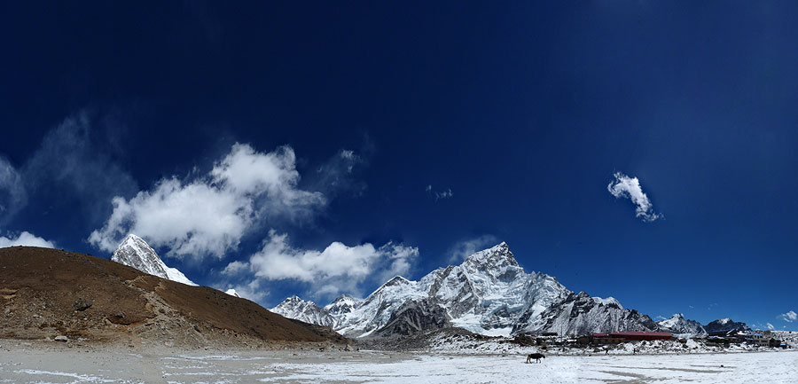
Everest Trek Part 3: Dingboche to Everest Base Camp
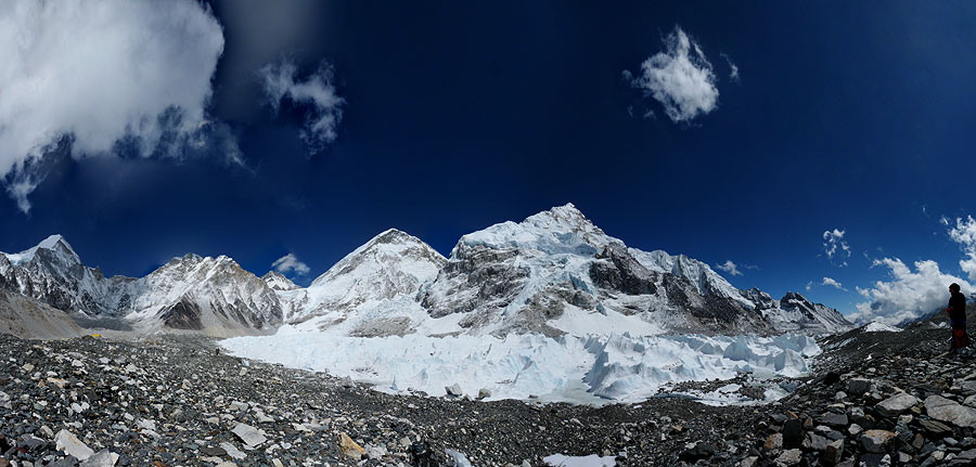
It was a magnificent panorama of mountains and glaciers and a tough walk to get here. But we'd made it.
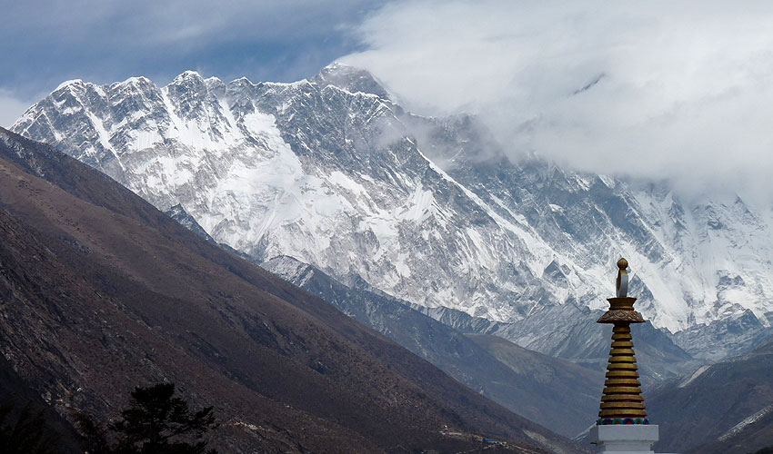
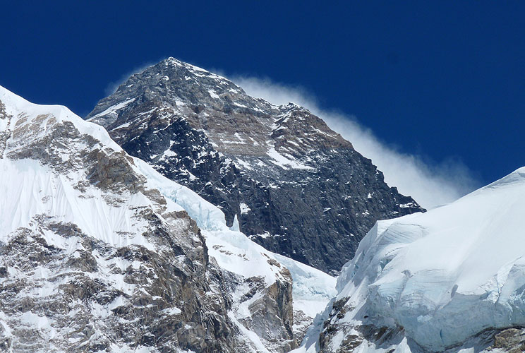
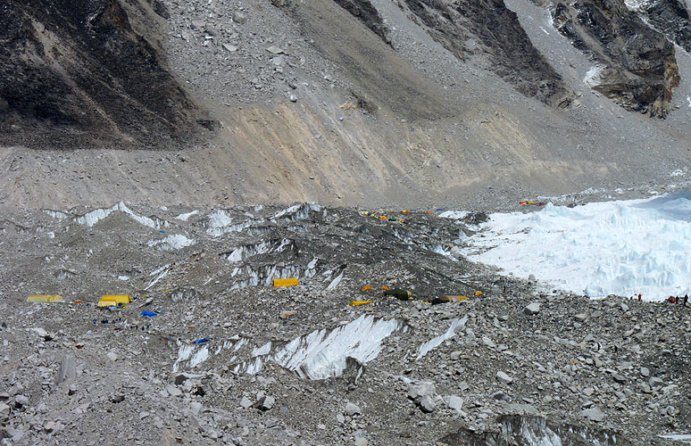
There were already some expedition tents on the Khumbu Glacier but there is no view of Everest from the base camp. We had seen the tip of the mountain several times as we walked towards it but, as ever, it was just a black piece of rock (actually limestone) that has had all the snow and ice blasted off it by the fierce wind up at 8,848m.
We also saw an avalanche - a huge piece of the glacial snow on Nuptse broke off with a loud crack and came tumbling and roaring down the side of the mountain. Fortunately, no one was anywhere near it but some people instinctively started running away even though they were too far away to be in any danger.
It was a powerful reminder of how destructive nature can be and how helpless we are. Little did we know that less than a month later a real tragedy would occur - an avalanche between Camp 1 and 2 would kill 16 Sherpas on Mount Everest.
We set off back to Gorak Shep just after 2 pm but Kirsten was struggling. I even carried her camera for her which shows she wasn't feeling well. It could have been the water here because when I ordered two cups of hot water it was brown and I thought they had served us tea instead of plain water. No, that was the colour of the water even though it had been boiled! I'm not even sure if water purification tablets could help against it.
As soon as we got back, I sorted out our room so that Kirsten could lie down. She felt better later on and came down to the restaurant to eat Dhal Bhat and sat around the fire chatting to others. It was still well below freezing in the room and the toilets were a problem but we were only staying one night and then we would go down.
The next morning we decided not to climb up Kala Pattar because of Kirsten's neck and I wanted to save my knees for Gokyo Ri - an upcoming steep climb where the views were far better. We set off after breakfast and met more of the people we'd been trekking with along the way who were now behind us.
We did 16km that day and descended all the way down to Pangboche, taking a different route via Pheriche on the way down. Kirsten was limping for the final 30 minutes because her right knee was playing up. When we got to the tea house for the night, she had an accident in the small toilet/bathroom, pee'd on her shoes, dropped the screw top of the Sigg bottle into the toilet and also tried to wash her hair in the freezing water! Later, we chatted to lots of other trekkers around the fire and Kirsten was losing her voice! Not her best day!!
We had been considering walking over Cho La Pass to get to Gokyo Lakes in the next valley but the pass had been closed due to heavy snowfall and had only opened up again the day before we would have gone over. We have no crampons with us so we decided not to risk it and to take the long route, walking via Pangboche around the valley head.
Our decision was rewarded by the most magnificent views of Everest and Lhotse on the way from Pangboche. We had a tough walk to Thore, up a very steep ascent and spent the night in a very basic tea house where the toilet was not just outside, but down a number of steps in a kind of shed. Not good if you need to get up in the middle of the night!
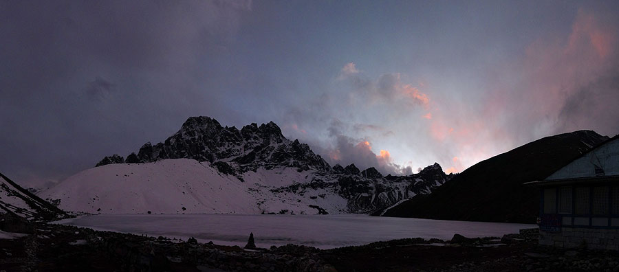
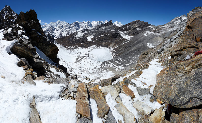
It was a hard slog up to Gokyo climbing steep steps cut into the rock side and then over a large area covered in snow and strewn with large boulders. Kirsten lost her voice completely and was having difficulty breathing through her blocked nose so we were both really glad to get to Gokyo and huddle around the fire.
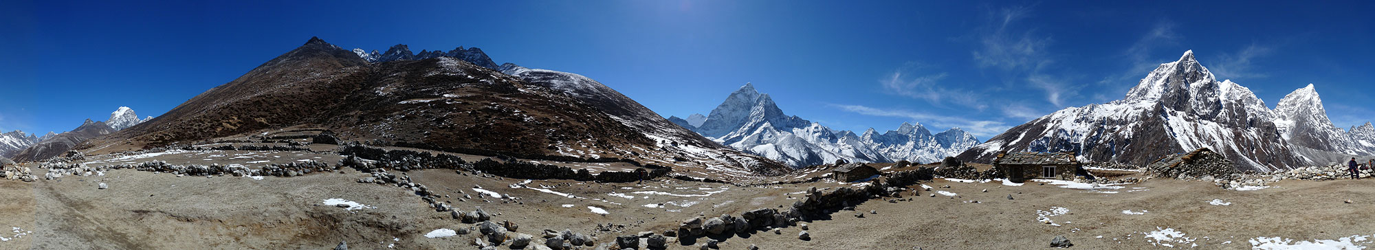
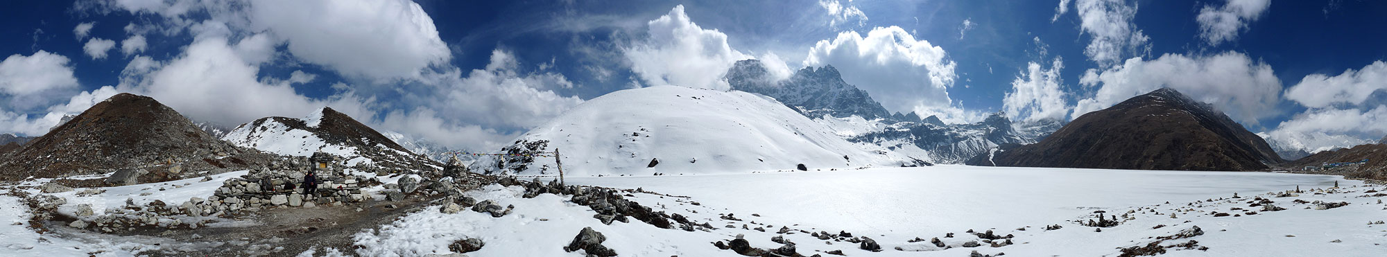 Reaching Gokyo (4790m)- 360° Panorama
(move mouse over panorama and click on the arrows)
Even our alarm clock was suffering - the display kept disappearing and constantly needed re-setting but at least the alarm still worked despite the blank display!
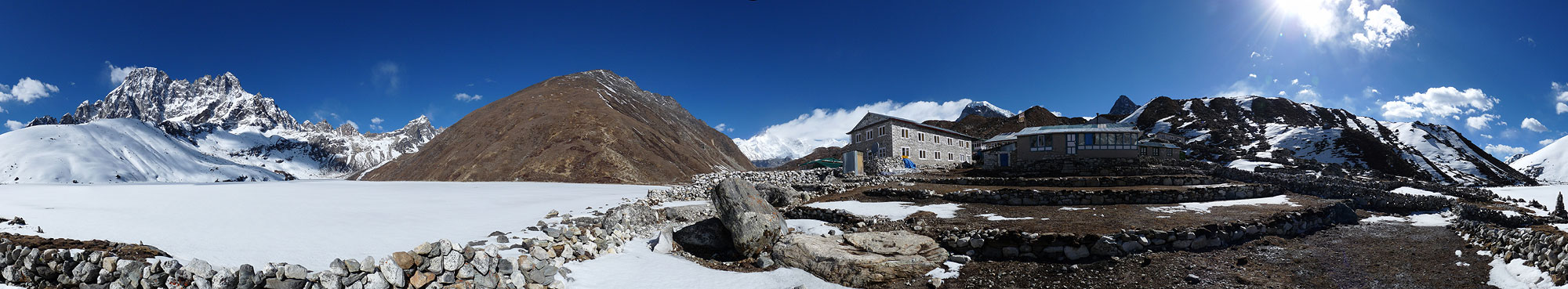 Gokyo the nest morning - 360° Panorama
(move mouse over panorama and click on the arrows)
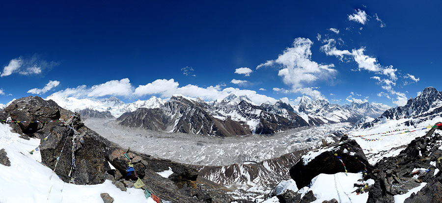
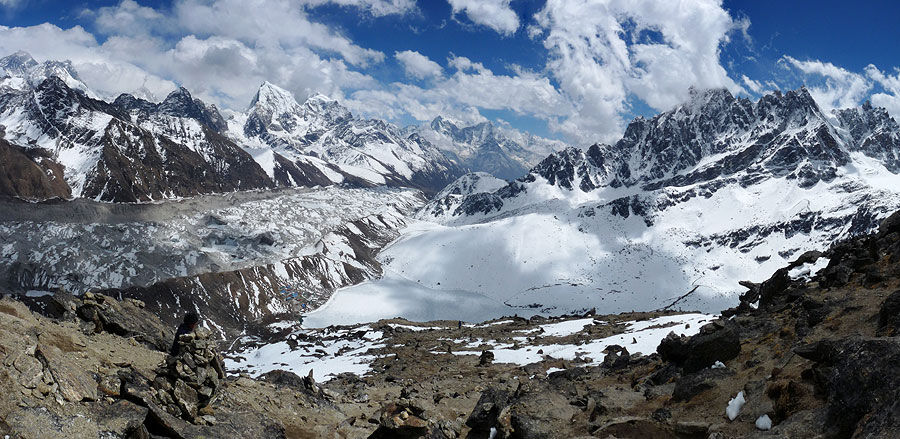
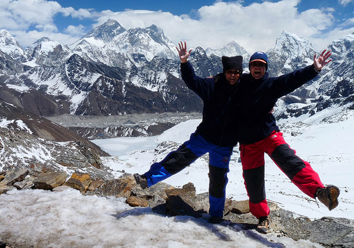
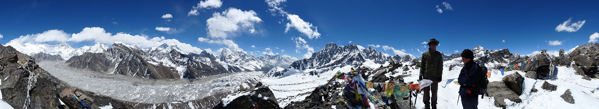
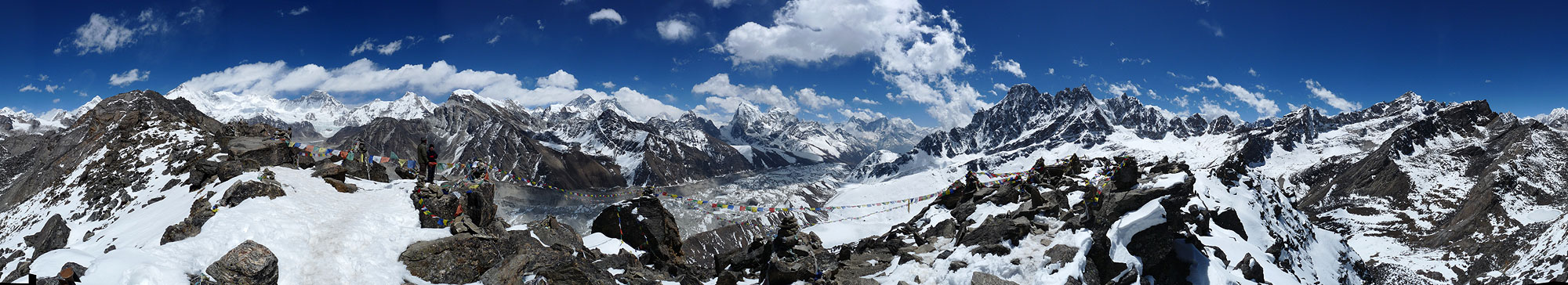
We spent two nights in Gokyo and climbed steeply up Gokyo Ri (5360m) for the magnificent views of the surrounding mountains. From here we could see 5 out of the 6 highest mountains in the world!!! Fantastic.
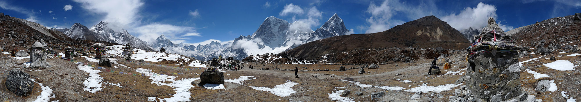
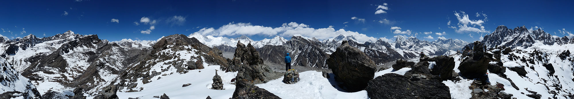 View from Gokyo Ri (5360m) - 360° Panorama
(move mouse over panorama and click on the arrows)
 View from Gokyo Ri (5360m) - 360° Panorama
(move mouse over panorama and click on the arrows)
 View from Gokyo Ri (5360m) - 360° Panorama
(move mouse over panorama and click on the arrows)
Everest Trek Part 4: Gorak Shep nach Gokyo Ri
The next day we got an early start and climbed up and over the Renjo La Pass (5360m) in to the next valley. It was treacherous and an extremely steep climb through snow and ice to get to the pass. I slipped and fell on my coccyx which was very painful and we were both coughing constantly.
Exhausted, we made it up to the pass where we met a group of people coming from the other direction and shared our gummi bears as a treat!
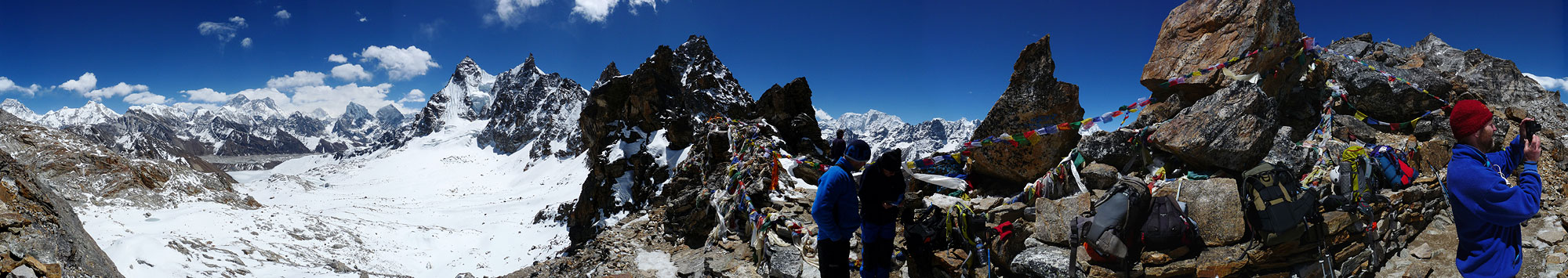 View from Renjo La Pass (5340m) - 360° Panorama
(move mouse over panorama and click on the arrows)
It was even worse descending the other side through more snow and ice and it was bitterly cold with a very strong wind. We arrived at the next tea house in Lumde completely drained. Why are we doing this? I guess it's a bit late to ask that now seeing as we were only two days from Lukla!
We made it all the way down to Namche the following day despite a very strong head wind and a path that constantly went up and down and was steep most of the time! We handed in our rented sleeping bags that hadn't done us much good. We'd have been better off using just blankets!
The last day back to Lukla nearly killed us. You are supposed to feel full of energy when you get back down to lower elevations but the 17km seemed further, harder, steeper and far tougher than we had thought. We were also coughing the whole way and we didn't think we would make the last steep zig zag up to the town.
We passed a huge number of groups and other trekkers just starting off on their quest to reach Everest Base Camp including a group of US war veterans with prostheses and their film crew who were going to attempt to climb Mount Everest despite, or because of, their missing limbs. They had special attachments that would allow crampons to be fitted! (We heard later that 90% of the expeditions to Everest were cancelled because of the avalanche deaths so we have no idea if they still made an attempt or not.)
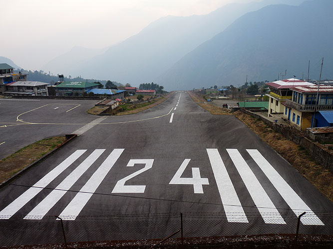
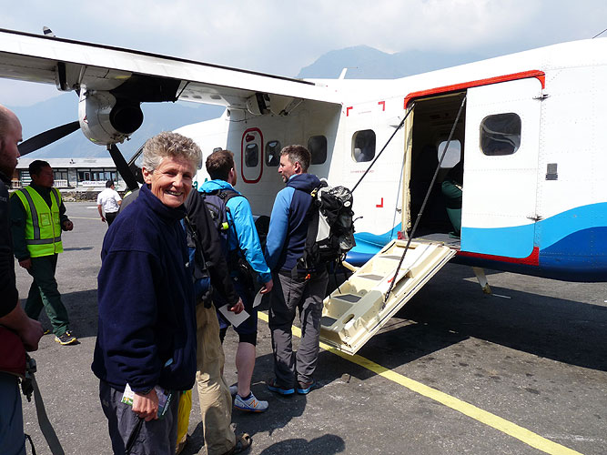
The airport in Lukla is not only the most dangerous in the world but is also the most chaotic! Maybe there is a system, but we certainly didn't understand it. We had got our agent to change our flights for us as we had booked them fro the 10th April and had arrived in Lukla 9 days earlier than planned.
Despite having tickets it took hours to finally get through the chaos and get our bags checked onto a flight at 10-20am. The plane revved up it’s engines so much that the plane was shaking. Then the pilot released the brakes and we shot off along the steep downhill incline of the extremely short runway and, somehow, managed to lift off right at the end of it!
I had expected the plane to drop sharply at the end of the runway before the engines got enough power to lift us back up. Surprisingly, that didn't happen. The lift off was smooth and the flight back to Kathmandu was only 25 minutes! The taxi back to our hotel took twice as long!
Everest Trek Part 5: Gokyo via Renjo La Pass to Lukla