


Click on a photo to enlarge it.
We got our G&T vehicle insurance in Santa Elena (GPS coordinates: N16 55 14.9 W89 53 29.5) for one month which covers us for Guatemala, Honduras, and Nicaragua. It was supposed to cover us for
Costa Rica but that wasn't the case when we later got to that border and it's also supposed to cover us for El Salvador although it
will have run out by the time we get to that country.
After filling up with propane we took a wrong road. After turning around we got on a really bad road that is supposed to get us south
to a ferry across the Rio de la Pasion in Sayaxche. When we asked a local they told us that this road is like that for the next 12 miles! So we took a different road that
according to our paper maps is not very good but turned out to be tarmac and in good condition. Even the maps aren't reliable!
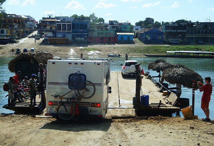
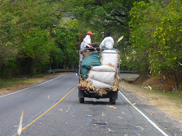
We'd already had a late start and then we lost an hour trying to find a good road. We didn't have too long to wait for the ferry which
only took a few minutes to get across the river. It cost $2 but it was not easy for Winnie to get on and off.
Ferry across the Rio de la Pasion in Sayaxche
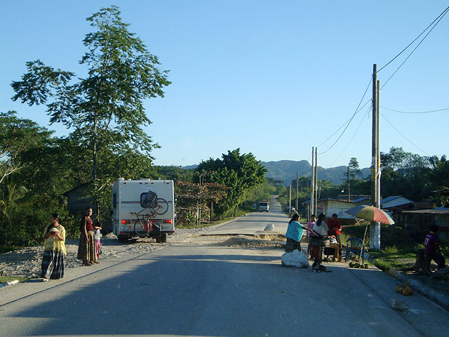
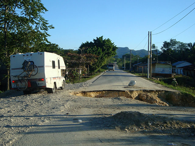
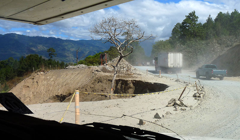
Then we had a stretch of road that had been badly damaged by landslides and rain damage. We stopped at a petrol station in Chisec for the night
but had to move off early because we were parked in the area they use to wash large trucks. We stopped at the small village for breakfast
and watched as they literally closed the road where we were about to drive and started digging it up! As a result we had to take a
very bumpy and rocky detour.
Going up to Cobán was slow going as we were going from 500 m to 1400 m above sea level. We stopped at a supermarket that stocks
Wal-Mart brand items and we found an internet so Kirsten could download a new version of our GPS software to try and get it working
again.
Helmut has GPS but at the moment we have to ask them for co-ordinates, transfer them onto our maps so we can find out where we are
and work out which street we have to take. Not easy seeing as we have to stop each time.
It took us quite a while to get out of Cobán and find the right road out. Our next stop was Lanquin which is at 600 m above sea level
and therefore a 900 metre drop. The road we were on seemed to be staying at the same level and we kept wondering when we would start
going downhill.
We came to a hairpin turn for Lanquin that is just 6 miles from the town and suddenly found ourselves on a really steep downhill
stretch of road that was literally just rocks. We bumped and banged our way down thinking it would get better around the next bend.
Wrong!!
With nowhere to turn around we had no choice but to continue for half a mile to a spot where we could. Winnie is automatic which
means that even in first gear we still had to keep the brakes on the whole time. At that rate we would get only 2 miles and have to
stop for an hour to let the brakes cool down, to say nothing of the problem of trying to get back!!
Somehow we managed to get back to the top and as it was already quite late we parked at the side of the road for the night.
Not really a good day today - we were told to leave just after 7am; the road is destroyed right in front of us; our GPS isn't working
when Kirsten spent 3 months working on a plan that is based on us having GPS; we took a different route to get to one of the highlights
which meant missing out other things on the way and now can't even get to see that; Helen's bites are driving her crazy; and Kirsten
bought some chocolate which would have been the worst chocolate we'd ever had until we found out it's meant to be broken into squares
and put into hot milk. No wonder it tastes so bad!
Oh well, it can't all be perfect.
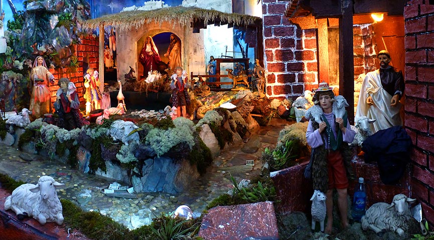
Our plans had to be changed again as we were looking for a place where we could stop for a few nights over Christmas. We had chosen
Lanquin which was now out of the question. So we continued heading south checking out places en route. We finally settled on Parque
Natural El Quetzal (Mario Dary Rivera). Quite a mouthful!
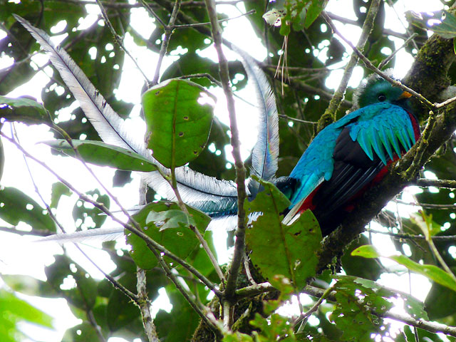
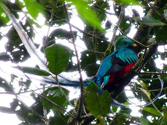
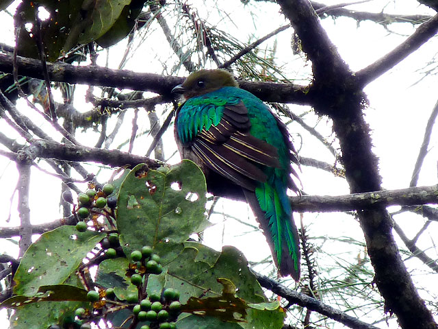
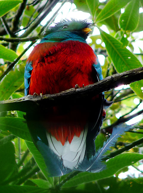
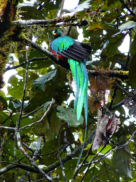
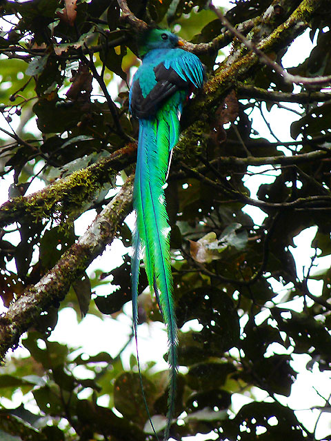
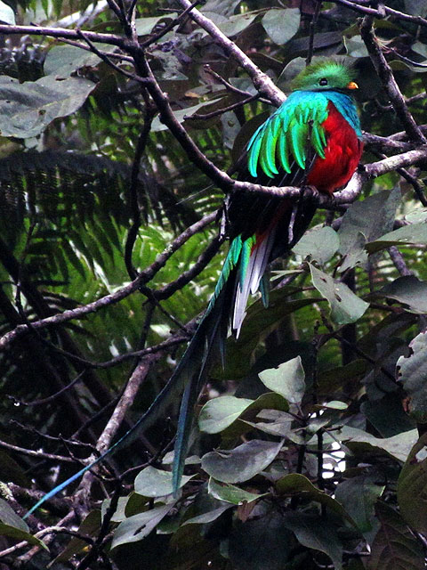
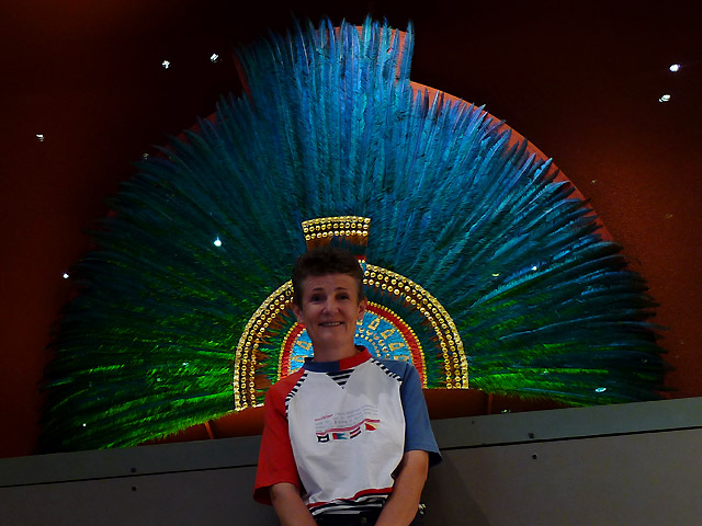
The Quetzal was the sacred bird of the ancient Mayas and Aztecs. The Mayan kings used the feathers from the males for their head ware -
e.g. Moctezuma's head dress. Today it is the national emblem of Guatemala and is also the name for the currency. The birds are
certainly very beautiful but rarely seen and we had information from other travellers that it is not easily found and certainly not
at the park where we would be staying!
It turned out that they were wrong because within 20 minutes of arriving we saw them and they came back every afternoon to feed. So
we had ample opportunity for photos.
Quetzals im Biotopo del Quetzal Mario Dary
We parked up next to one of the employees huts behind a gate and it was only $5-50 a night which included electricity water and shower.
The problem was that the weather didn't hold up. In fact it rained virtually the whole time we were there and Winnie had the worst
leaks we have ever had. We had to go out in the pouring rain to put the tarps up on the roof at 6am because we couldn't cope with
all the bowls and towels we were using inside.
We found out 2 weeks later that we didn't have any leaks at all but it was raining through the vent above the fridge which we had
blocked off with aluminium tape at the front to stop the water going in whenever we drove in the rain. Add a few leaves and other
debris that had got stuck up there and we ended up with a situation that literally guided the rainwater inside.
It took us a while to work that one out though and in the meantime the rain was a continual pain and a constant battle to get things
dry. It didn't help that we were staying in the rainforest so it's not surprising that it rained virtually the whole time we were
there and Christmas was a wash out.
We did try to get into the Christmas mood by watching The Sound Of Music which Kirsten has never seen - it was never shown in Germany.
But our downloaded copy on the computer jumped and missed out about 20 minutes and then jumped back again. Helen tried to explain what
was missing but it detracted from the overall effect somewhat!
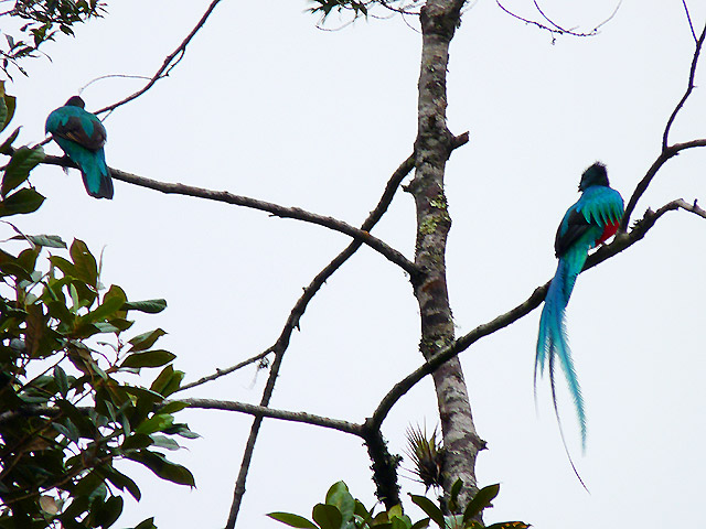
On Boxing Day it stopped raining at 1pm so we quickly went into the park and did a 2 hour hike along a trail to the viewpoint. We
stopped to see the Quetzal birds on the way back just before it started raining again.
We left the next day but it took us 2 hours to get the tarps down and everything else we had put up onto Winnie's roof (buckets and
bowls and wooden sticks) to try and create a tent effect and let all the rain water run off, and pack up to leave. We had showers
and then went to thank the people there and to see the Quetzal birds again.
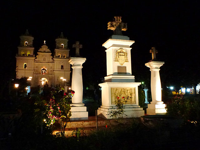
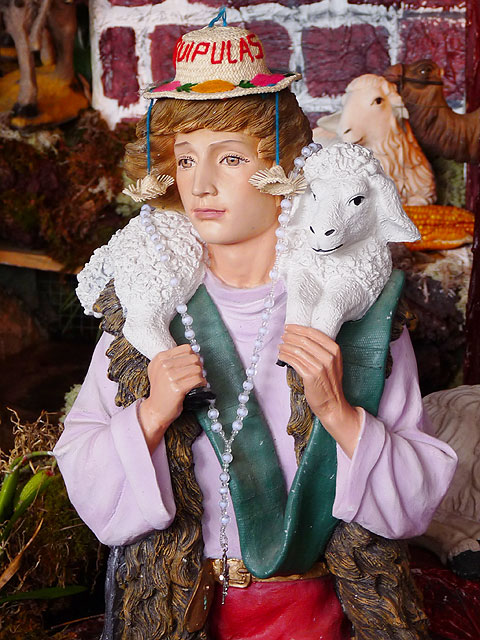
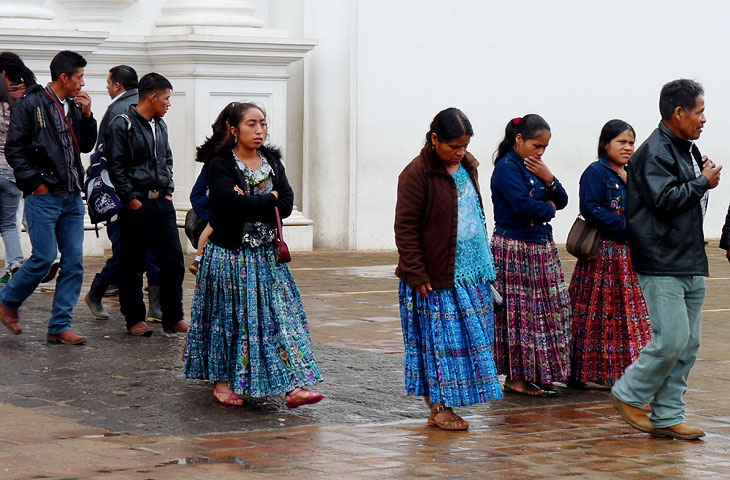
We drove towards the border with Honduras to Esquipulas and the GPS took us through the narrow and busy streets of the town on a
market day! We were looking for the Basilica which is huge and can be seen from far away except that we had the wrong coordinates!
We finally got back to it but the parking area we were looking for seemed to be in the middle of packed streets. So we drove back out
to the main road to the Hotel Gran Chorti we had seen and asked if we could park on their car park for the night.
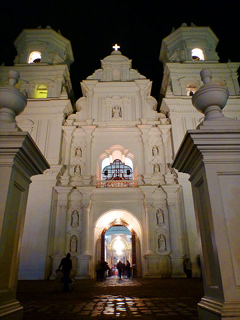
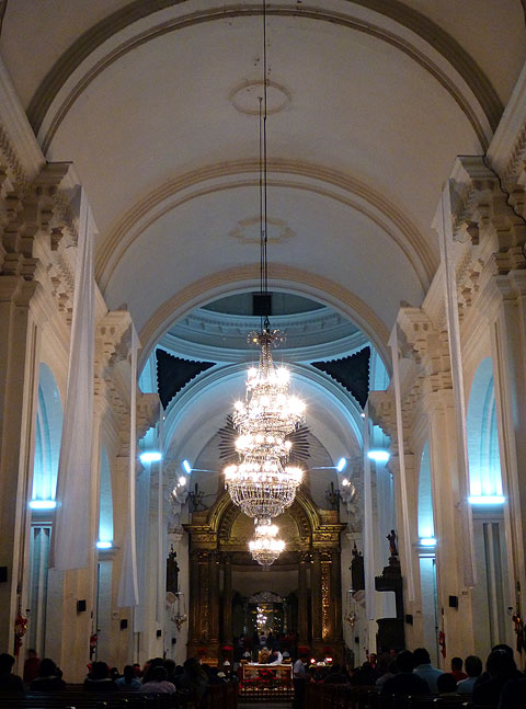
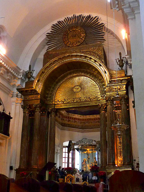
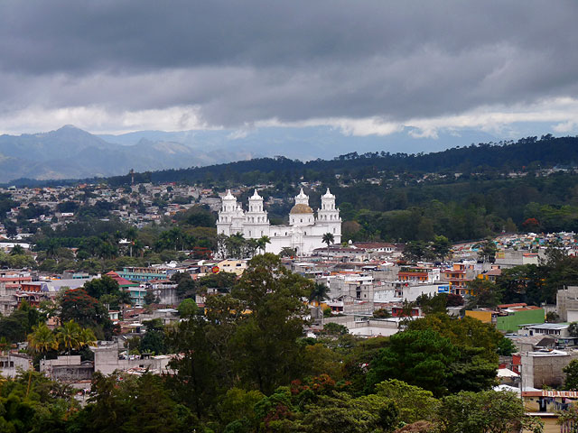
It was already getting dark but we wanted to see the Basilica which has managed to resist earthquakes for over 250 years. It is a
massive white structure with an impressive façade and towers that are floodlit at night. There was a really long queue to see the
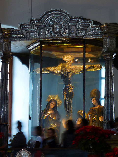
famous statue of the Black Christ (El Christo Negro) which is approached with extreme reverence by the devout, some on their knees.
The statue is encased in glass and the queue of people go slowly by and barely have time before they are "encouraged" to move on by
the next in line.
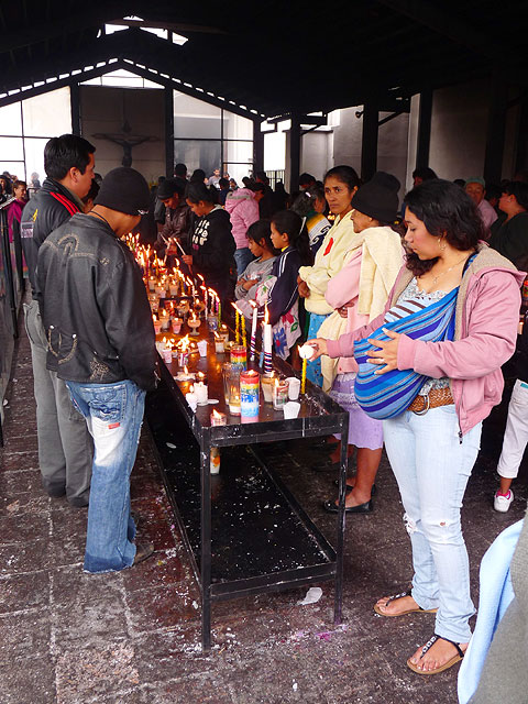
We went to a fast food restaurant in between to wait for a church service to end and to try to avoid the throng of people. There was
even a queue to light candles in a separate annex at the side of the church.
Kirsten went back to the Basilica the next morning with Helmut and Agnes whilst Helen kept an eye on the vehicles.
Esquipulas
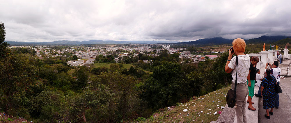
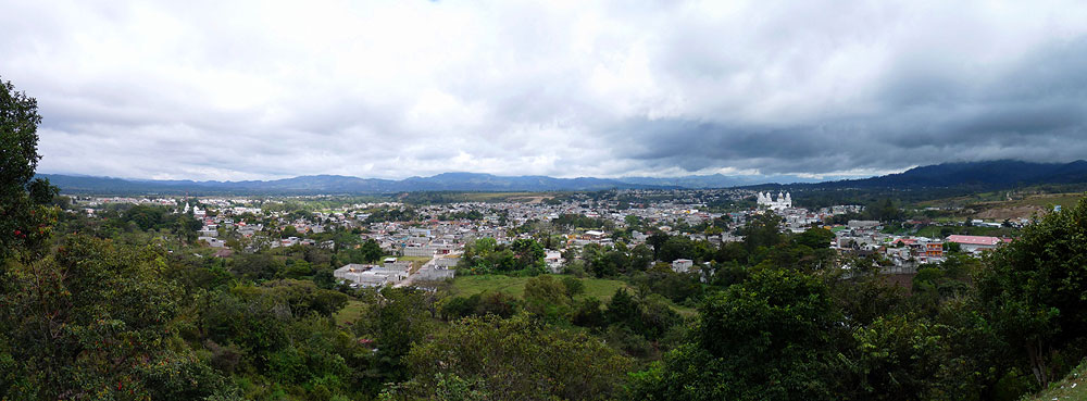
After a stop at a viewpoint from where the full size and majesty of the building can be better appreciated, we headed uphill into
the mountains to the border with Honduras. It was a complicated crossing into Honduras with lots of copies needed and fees that are
expensive in comparison to all the other countries in Central America.
We were continually surrounded with people trying to get money from us for this, that and the other and never trusted any of them.
The official dealing with the vehicle permit even wanted a photo copy of our registration sticker which is attached to our rear
license plate!! Fortunately it was easy for us because we haven't attached the new sticker yet - we left the US before we needed to
attach it and decided it would be safer if we didn't attach it until we drove back onto US soil. So we didn't need to remove the
license plate and take it to a photocopier!!
Honduras does not make it easy for tourists to drive in and we certainly didn't feel welcome. By the time we managed to drive off
we felt wrung out so it was good that we only had 7 miles to drive to our next destination - Copán Ruinas - even though we encountered more landslide
damage and a bridge was out.