Click on a photo to enlarge it.
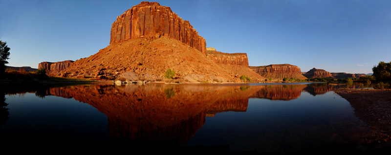
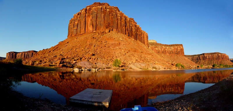
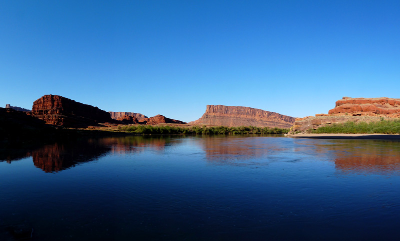
From Silverton we drove over Red Mountain Pass (11,018ft) heading west towards Canyonlands. We stopped at a free BLM campground in Caddis Flatts on the way and got
to a free area just before the entrance to Canyonlands the following day.
Dangerous driving over Red Mountain Pass
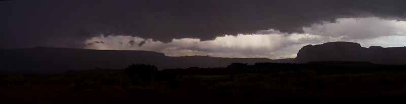
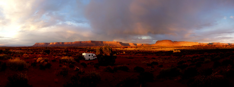
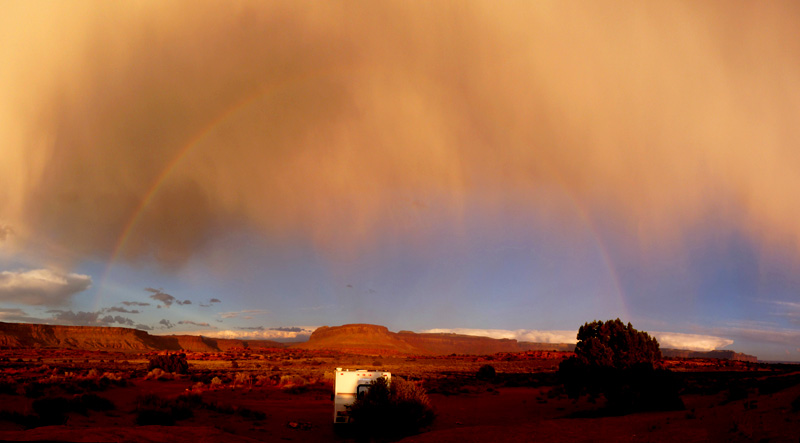
We decided to have a day off and enjoy the good weather but a thunderstorm came over in the afternoon and it started raining. This
was the weather pattern for almost a week - sunny in the mornings but thunder and lightening and rain in the afternoons.
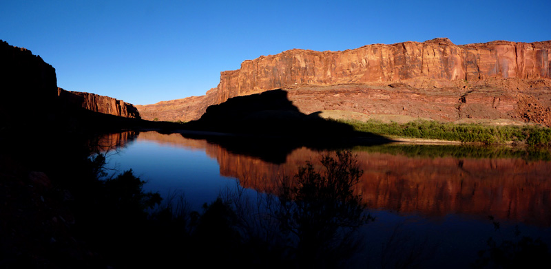
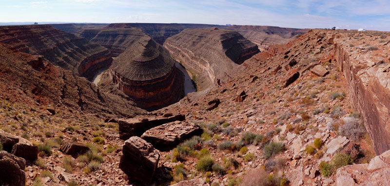
Thunderstorms in Canyonlands NP
We had our weather radio and decided to sit it out whilst we used the phone at the visitor centre for the free phone calls to renew
our insurance and AAA membership and various other things we needed to do.
We wanted to do some hiking in the area but with the flash flood warnings it was too dangerous. Unfortunately our weather radio got
it wrong on Thursday 7th October. Thunderstorms were predicted but the weather was sunny all day! Oh well, so we missed a great
hiking day!
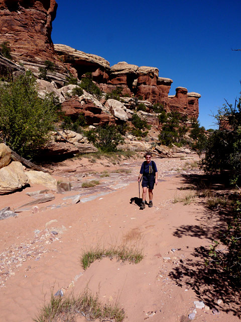
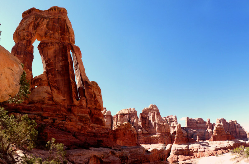
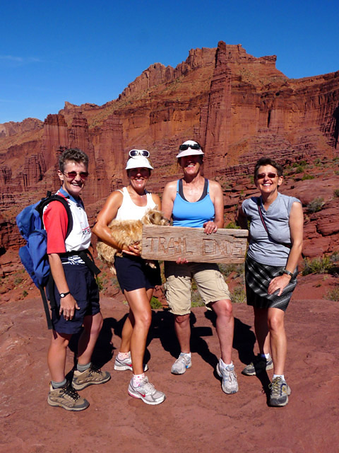
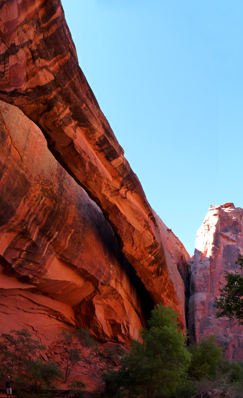
We set off the next day and did a 14 mile hike to Druid's Arch. It took us just over 8 hours and is not an easy hike. The last part
you have to scramble up rocks and there is also a ladder that you have to use to get across a rift.
Helen climbing the ladder near Druid's Arch
The arch was in the sun as the best time for photos is in the morning but that would mean we would have to camp close by. We also had
to get back before dark so Kirsten only had 10 minutes for photos!
On the way back we needed to step on the gas and had to trudge back through a very sandy wash. Helen caught her foot on a rock and
the force ripped her boots right across the toe from left to right! She didn't hurt herself - or didn't realise until we were
trudging through the sandy wash and pushing hard to get back before dark.
Then she realised that she had a problem with her left knee. Obviously she had pulled a tendon or something and the walk back became
a limp rather than a race. We only just got back before dark!
We had wanted to do another hike around Chesler Park which we had done years ago but because of the left knee we decided to leave it
out and we drove into Moab. We did the usual shopping and library and then drove out to try and find a free campground. The BLM
campgrounds are all charging $8-12 now but we had heard of a free place at Onion Creek.
There were several designated free areas to camp but we had to keep crossing the creek which had quite a bit of water in it. Every
camping area was full and we crossed the creek eight times! The next creek crossing was followed by a very steep uphill stretch of
dirt road. We knew we wouldn't make it. So we had to give up and turn around.
Winnie crossing the streams
That little excursion took us about one hour and it was getting dark. We checked out two other paying camping areas which were full
and got to the final possibility in the dark! We only got a space because everyone else thought it was already taken as there were
cars parked there. But they belonged to people staying in tents. So we finally managed to get a space which cost us $12 for the night.
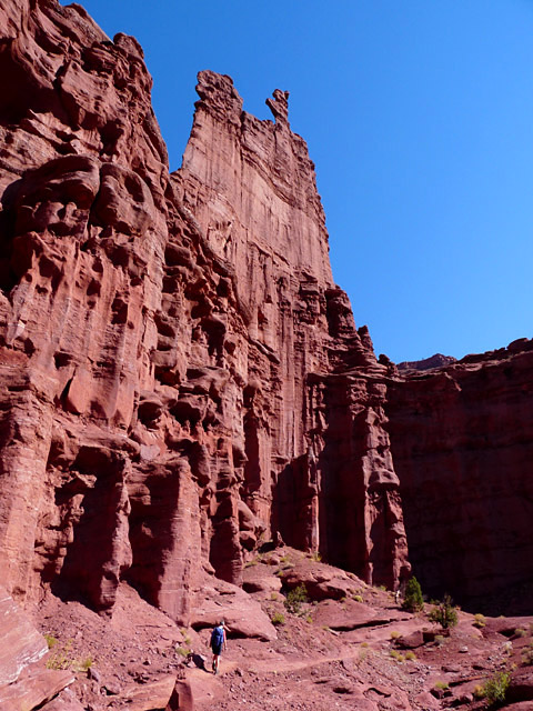
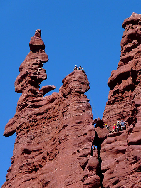
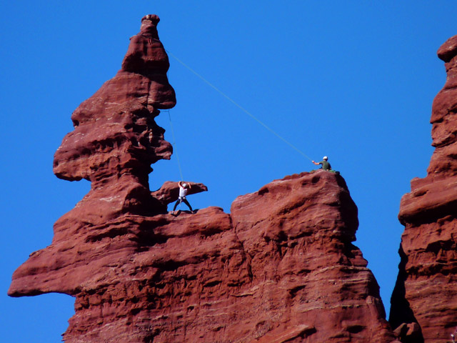
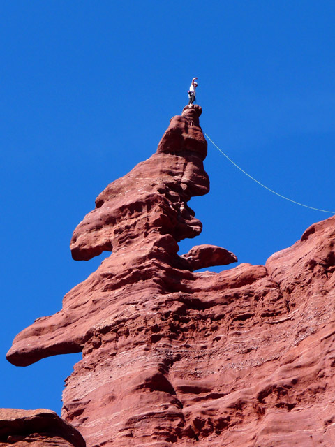
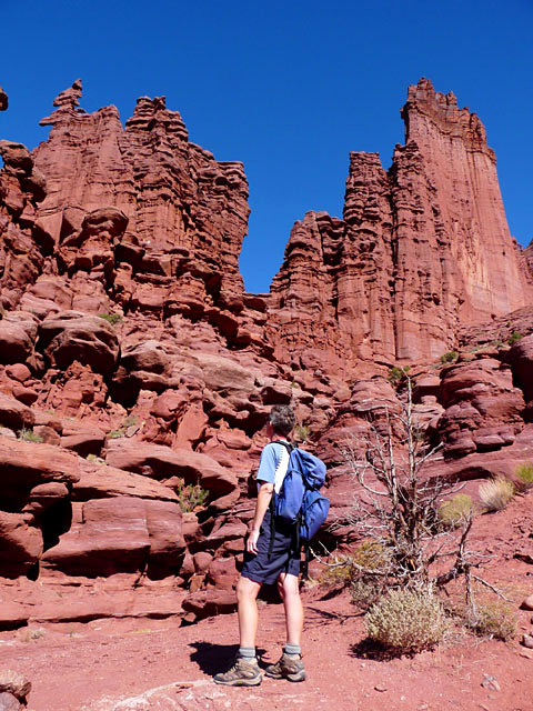
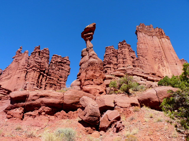
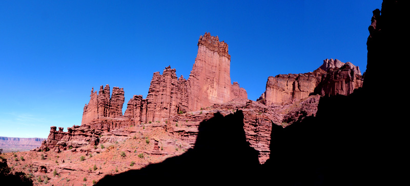
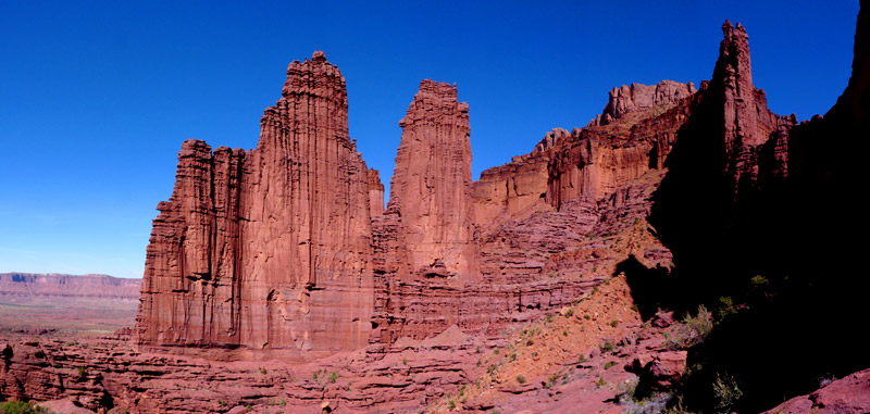
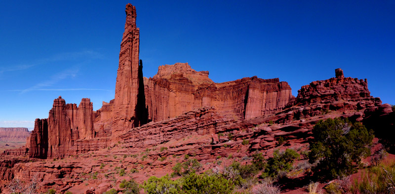
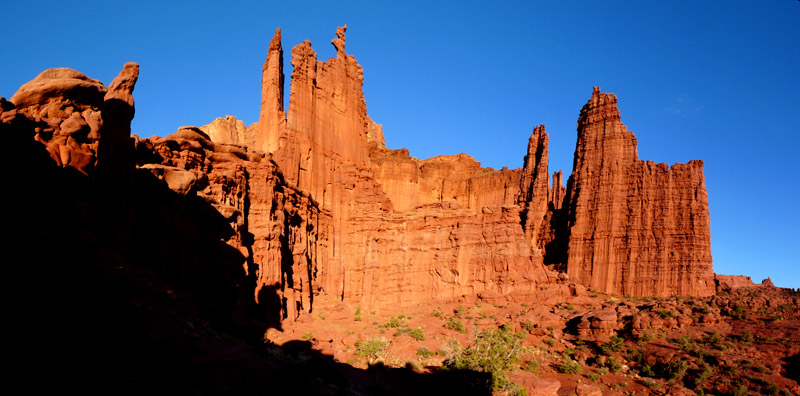
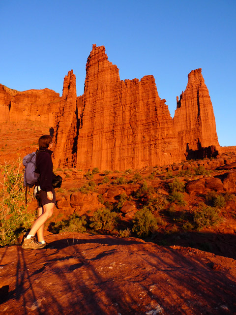
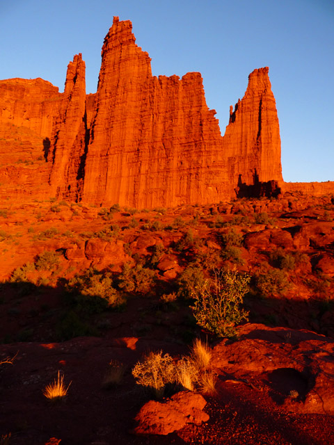
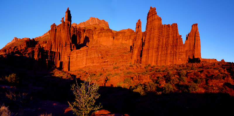
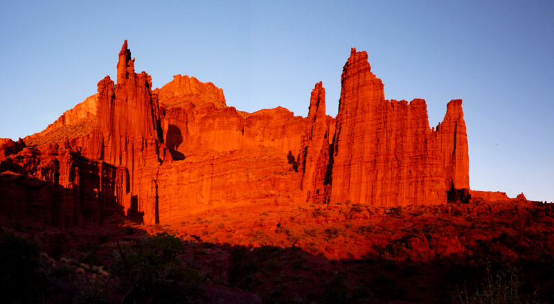
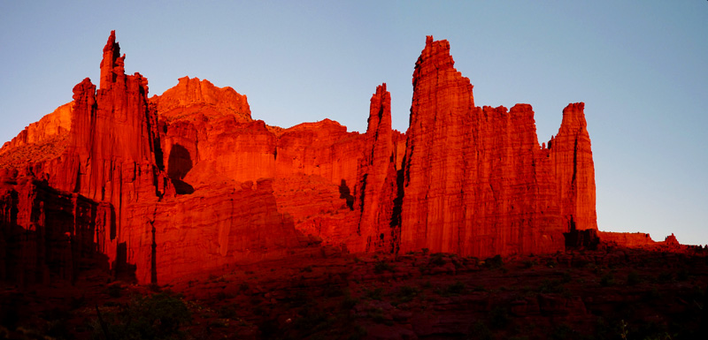
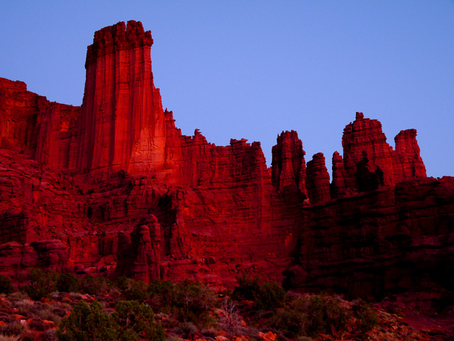
The next day we did a super hike to Fisher Towers. If these rock formations were anywhere else in the world they would be part of a
National Park or a major tourist attraction. But here, where there is so much to see and so many major attractions they are virtually
a secret.
The walk is described as easy but it's not. There are several ups and downs, ledge walking with a steep drop off, ladders and about a
1,000 ft elevation gain, but it is still a really good walk and well worth the drive out here.
We saw some rock climbers and watched as they climbed up onto one of the pinnacles. We also met people with dogs who had to negotiate
the ladder with their owners. The walk was 5 miles but it took 4 hours because of all the photo stops etc.
Hiking obstacles at Fisher Towers
We can definitely recommend this walk.
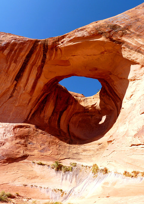
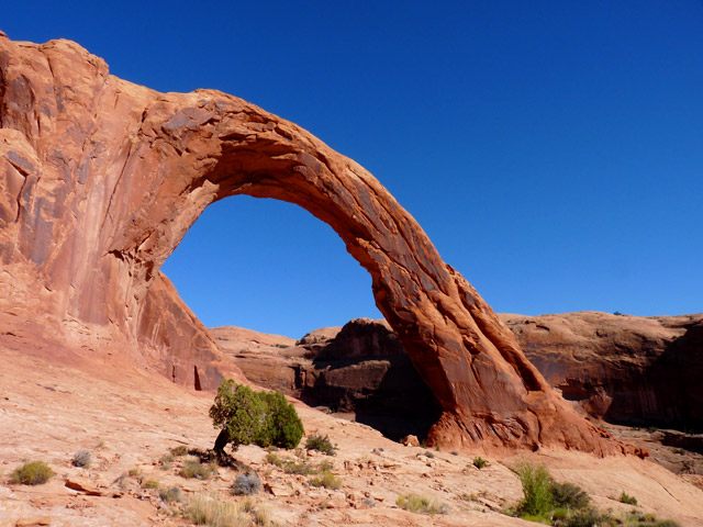
The next walk we did was also classed as easy and this was actually was! It was a 5 mile round trip to Morning Glory Arch crossing
the creek seven times over stepping stones or logs. We spent the afternoon in Moab sorting a few things out and then drove out along
the Potash Road. Right at the end we found a parking area and stayed there for two nights.
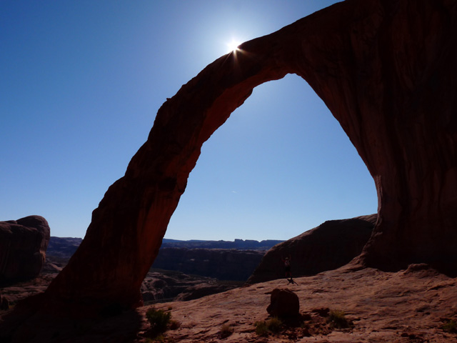
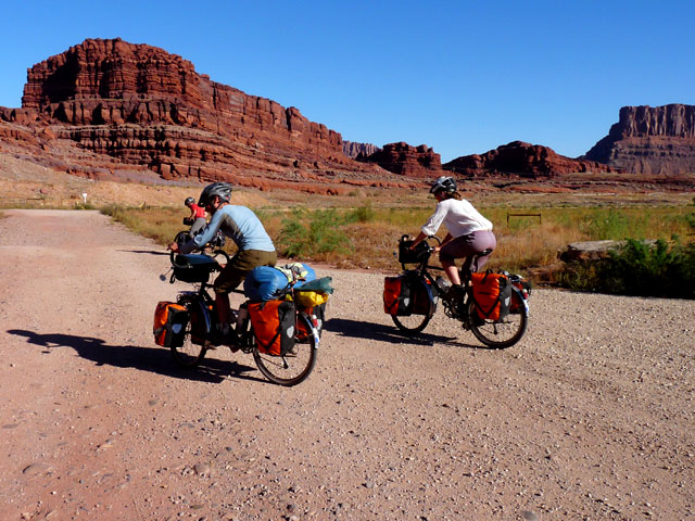
On the day in between, we did a 4 mile walk to Corona Arch and Bow Tie Arch. Back at the parking area we met Florent and Aurelie who
are cycling around the world! They have already done two of the planned four years and are on their way south to Mexico, Central and South America.
We spent the evening giving them some tips about Mexico. They loved us – not for the tips but because we brought along grapes and
chocolate!! We didn't realise that they were living on pasta and cheese for the whole trip. Well, they don't have a fridge with them!!
Aurelie's father Yves had joined them in Salt Lake City and was doing a four week stretch with them.
It made us appreciate Winnie even more. We certainly couldn't cycle around the world. Our way of travelling is far more luxurious!
We went to a campground in Moab because we wanted to do our laundry, recharge batteries etc but the place was full. Other campgrounds
were too expensive. So we used a free dump station and left Moab.
Our computer has been playing up for a long time now. We hardly ever get Wi-fi as, for some reason, it just doesn't work, and it has
been getting harder and harder to get it started. It has finally given up the ghost - a real problem because we need to download
photos and get our website done. We also use the computer to phone.
So we tried to find somewhere to get our computer fixed, but Moab is too small. We need a bigger place to get some help with it. Our
only hope was the next relatively big place which would be Page, Arizona.
From Moab we drove to the BLM area at San Raphael Swell where we have been before. The camping areas were pretty full as there was
some kind of ATV meeting going on.
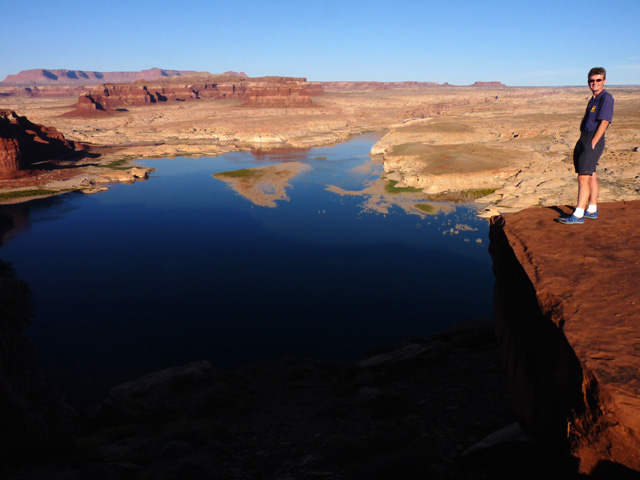
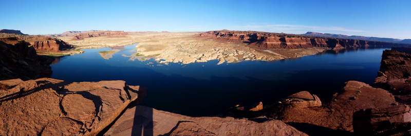
Then we drove south along highway 95 and through Glen Canyon National Recreation Area. It was a very nice drive through the canyon.
There was a lot of evidence of flash flood damage though so that must have been the storm we had to sit out in Canyonlands.
We stayed at Hite Overlook for the night and then continued south down the steep switchbacks and stayed at Gooseneck State Park for
that night.
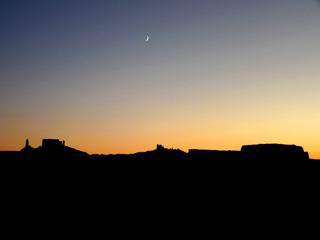
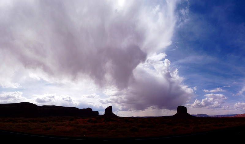
On the last stretch to Page we stopped at Monument Valley only to find that they are now charging $5 per person just to get through
the entrance station and go to the visitor centre. The former campground where we stayed years ago no longer exists and they have
built a hotel there. There is another camping area but with no facilities which costs $10.
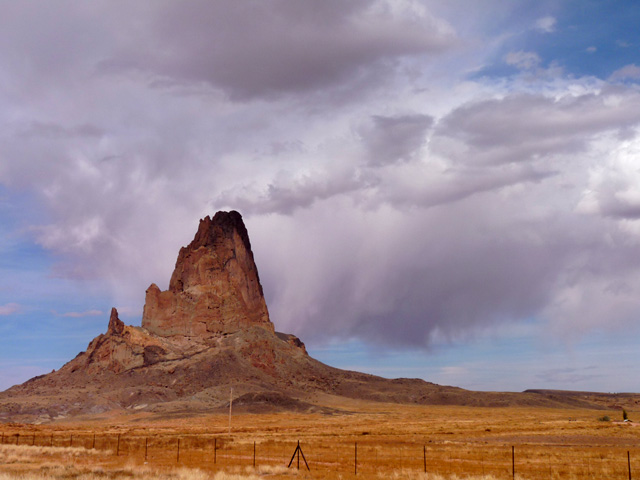
We drove out passed Agathla Peak which Kirsten kept saying was Ship Rock because it looks the same. Only Ship Rock is in a different
State and would be behind us not in front of us as Agathla Peak was!!
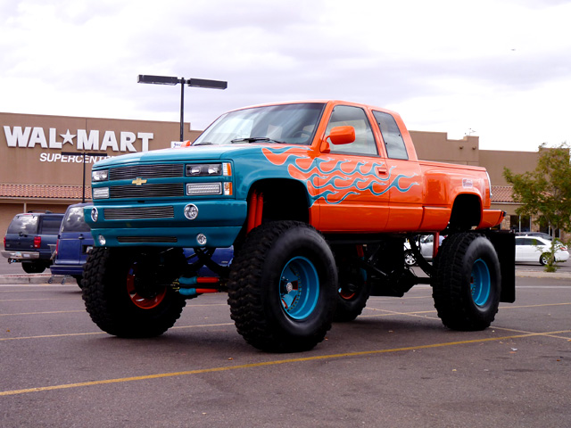
We got to Page just after 5pm, did some shopping and stayed on the Wal-Mart car park in the rain! Quite a difference after all the last
camping areas we have stayed in!